
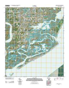
~ James Island SC topo map, 1:24000 scale, 7.5 X 7.5 Minute, Historical, 2011
James Island, South Carolina, USGS topographic map dated 2011.
Includes geographic coordinates (latitude and longitude). This topographic map is suitable for hiking, camping, and exploring, or framing it as a wall map.
Printed on-demand using high resolution imagery, on heavy weight and acid free paper, or alternatively on a variety of synthetic materials.
Topos available on paper, Waterproof, Poly, or Tyvek. Usually shipping rolled, unless combined with other folded maps in one order.
- Product Number: USGS-5280069
- Free digital map download (high-resolution, GeoPDF): James Island, South Carolina (file size: 20 MB)
- Map Size: please refer to the dimensions of the GeoPDF map above
- Weight (paper map): ca. 55 grams
- Map Type: POD USGS Topographic Map
- Map Series: US Topo
- Map Verison: Historical
- Cell ID: 22358
- Datum: North American Datum of 1983
- Map Projection: Transverse Mercator
- Map Cell Name: James Island
- Grid size: 7.5 X 7.5 Minute
- Date on map: 2011
- Map Scale: 1:24000
- Geographical region: South Carolina, United States
Neighboring Maps:
All neighboring USGS topo maps are available for sale online at a variety of scales.
Spatial coverage:
Topo map James Island, South Carolina, covers the geographical area associated the following places:
- Riverview - Fort Johnson Estates - Battery Point - Grimball Shores - Old Orchard - McCalls Corner - Quail Run - Farmington - Whitehouse Plantation - Kings Acres - Tidalview - Honey Hill - Oyster Point - Lee Jackson Estates - Bayfront - Teal Acres - Stono - Holiday Acres - Secessionville Acres - Folly Beach - Greencrest - Secessionville - Oceanview - Woodhaven - Three Trees - Creek Point - Riverpoint - Marsh Point - Dellwood - Camp Road Estates - Queensborough - Seaside - Parrot Point - Landsdowne - Oswald Place - Clarks Point - Green Hill - Clarks Sound - Westchester - Bur Clare - Lakeview of Lawton Bluff - Centerville - Oakcrest - Lawton Bluff - Lynnwood - Harbor Woods - Stiles Point - Oakview Park - Jamestown Estates - Lockwood Hall - Lighthouse Point - Riverland
- Map Area ID: AREA32.7532.625-80-79.875
- Northwest corner Lat/Long code: USGSNW32.75-80
- Northeast corner Lat/Long code: USGSNE32.75-79.875
- Southwest corner Lat/Long code: USGSSW32.625-80
- Southeast corner Lat/Long code: USGSSE32.625-79.875
- Northern map edge Latitude: 32.75
- Southern map edge Latitude: 32.625
- Western map edge Longitude: -80
- Eastern map edge Longitude: -79.875


