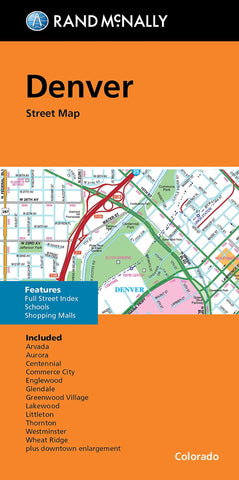
Denver, CO Folded Street Map
Rand McNallys folded map for Denver is a must-have for anyone traveling in and around this part of Colorado, offering unbeatable accuracy and reliability at a great price. Our trusted cartography shows all Interstate, U.S., state, and county highways, along with clearly indicated parks, points of interest, airports, county boundaries, and streets. The easy-to-use legend and detailed index make for quick and easy location of destinations. Youll see why Rand McNally folded maps have been the trusted standard for years. •Regularly updated. •Full-color maps. •Clearly labeled Interstate, U.S., state, and county highways. • Indications of parks, points of interest, airports, county boundaries, schools, shopping malls, downtown & vicinity maps. •Easy-to-use legend. •Detailed & full street index. •Convenient folded size. Coverage Area: Communities included, Arvada, Aurora, Centennial, Commerce City, Englewood, Glendale, Greenwood Village, Lakewood, Littleton, Thornton, Westminster, Wheat Rid
- Product Number: RM_DENVER_20N
- Reference Product Number: - None -
- ISBN: 9780528024900
- Date of Publication: 9/17/2020
- Folded Size: 9.5 inches high by 4 inches wide
- Unfolded (flat) Size: 40 inches high by 28 inches wide
- Map format: Folded
- Map type: Trade Maps - City Maps
- Geographical region: United States
- Geographical subregion: Colorado