
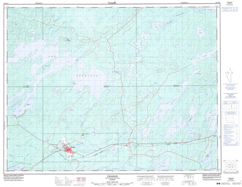
032G15 Chapais Canada topo map, 1:50,000 scale
032G15 Chapais NRCAN topographic map.
Includes UTM and GPS geographic coordinates (latitude and longitude). This 50k scale map is suitable for hiking, camping, and exploring, or you could frame it as a wall map.
Printed on-demand using high resolution, on heavy weight and acid free paper, or as an upgrade on a variety of synthetic materials.
Topos available on paper, Waterproof, Poly, or Tyvek. Usually shipping rolled, unless combined with other folded maps in one order.
- Product Number: NRCAN-032G15
- Parent Topo: TOPO-032G
- Map ID also known as: 032G15, 32G15
- Unfolded Size: Approximately 26" high by 36" wide
- Weight (paper map): ca. 55 grams
- Map Type: POD NRCAN Topographic Map
- Map Scale: 1:50,000
- Geographical region: Quebec, Canada
Neighboring Maps:
All neighboring Canadian topo maps are available for sale online at 1:50,000 scale.
Purchase the smaller scale map covering this area: Topo-032G
Spatial coverage:
Topo map sheet 032G15 Chapais covers the following places:
- Aéroport de Chibougamau-Chapais - Baie de l'Ouest - Baie Sioui - Deuxième baie de l'Ouest - Passe Opémisca - Chapais - Barlow - Cuvier - Daubrée - Lévy - Notre-Dame-de-Lourdes - Opémisca - Scott - Poste de Chibougamau - Poste Le Moyne - Île Deschênes - La Grosse Île - Première Île - Lac Acinitchibastat - Lac Assinibastat - Lac au Couteau - Lac au Sable - Lac Barlow - Lac Buckell - Lac Bud - Lac Campbell - Lac Cavan - Lac Chevrillon - Lac Dadson - Lac David - Lac des Joncs - Lac du Muguet - Lac Dulieux - Lac Five Mile - Lac Gagnac - Lac Gignac - Lac Goudreau - Lac Gwillim - Lac Héloïse - Lac Hook - Lac Lamoille - Lac Laura - Lac Ledden - Lac Marcelle - Lac Merrill - Lac Noël - Lac Opémisca - Lac Pégase - Lac Progress - Lac Rush - Lac Rush - Lac Sainte-Lucie - Lac Scott - Lac Simon - Lac Springer - Lac Trenholme - Lac Whiskeyjack - Lac Willac - Lac Williams - Petit lac des Joncs - Poste de Chapais - Mont Opémisca - Mont Springer - Rapides Entre les Îles - Mine Cooke - Mine Perry - Mine Springer-Deux - Mine Springer-Un - Rivière Chibougamau - Rivière Opémisca - Ruisseau à la Loutre - Ruisseau Cavan - Ruisseau Daubrée - Ruisseau des Marais - Ruisseau Everglades - Ruisseau Laura - Ruisseau Leclerc - Ruisseau Marquette - Ruisseau Springer - Ruisseau Trenholme - Chapais - Mine-Robitaille - Oujé-Bougoumou - Oujé-Bougoumou


