
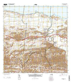
~ Barceloneta PR topo map, 1:20000 scale, 7.5 X 7.5 Minute, 2013
Barceloneta, Puerto Rico, USGS topographic map dated 2013.
Includes geographic coordinates (latitude and longitude). This topographic map is suitable for hiking, camping, and exploring, or framing it as a wall map.
Printed on-demand using high resolution imagery, on heavy weight and acid free paper, or alternatively on a variety of synthetic materials.
Topos available on paper, Waterproof, Poly, or Tyvek. Usually shipping rolled, unless combined with other folded maps in one order.
- Product Number: USGS-8537729
- Free digital map download (high-resolution, GeoPDF): Barceloneta, Puerto Rico (file size: 43 MB)
- Map Size: please refer to the dimensions of the GeoPDF map above
- Weight (paper map): ca. 55 grams
- Map Type: POD USGS Topographic Map
- Map Series: US Topo
- Map Verison: Current
- Cell ID: 2383
- Datum: North American Datum of 1983
- Map Projection: Transverse Mercator
- Map Cell Name: Barceloneta
- Grid size: 7.5 X 7.5 Minute
- Date on map: 2013
- Map Scale: 1:20000
- Geographical region: Puerto Rico, United States
Neighboring Maps:
All neighboring USGS topo maps are available for sale online at a variety of scales.
Spatial coverage:
Topo map Barceloneta, Puerto Rico, covers the geographical area associated the following places:
- Residencial Plazuela - Sabana Hoyos Comunidad - Cruce Dávila - Sector Cerro Morales - Sector Catanito - Islote - Imbéry Comunidad - Asomante - Garrochales Comunidad - Sector Cementerio - Garrochales - Búfalo Comunidad - El Cantito - Barceloneta - Villa Georgetti - Catalina - Cruce Magueyes - Imbery - La Alianza Comunidad - La Alianza - Residencial Antonio Davila Freyte - Pajonal Comunidad - Barceloneta Zona Urbana - Centro Vacacional Recidencial Recinto La Catala - La Luisa - Pajonal - Francisco O Ortega - Sabana Hoyos - Bufalo - Garrochales - El Cachete - Tiburones Comunidad - Sector Abra de Pimiento - San Luis - Tiburones - Villa Barcelona - La Luisa Comunidad - Barrrio Catalana - La Aldea - Sector Seboruco - La Romana - La Boca - Allende
- Map Area ID: AREA18.518.375-66.625-66.5
- Northwest corner Lat/Long code: USGSNW18.5-66.625
- Northeast corner Lat/Long code: USGSNE18.5-66.5
- Southwest corner Lat/Long code: USGSSW18.375-66.625
- Southeast corner Lat/Long code: USGSSE18.375-66.5
- Northern map edge Latitude: 18.5
- Southern map edge Latitude: 18.375
- Western map edge Longitude: -66.625
- Eastern map edge Longitude: -66.5


