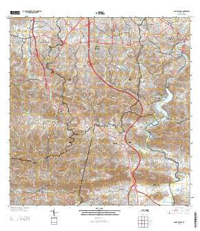
~ Aguas Buenas PR topo map, 1:20000 scale, 7.5 X 7.5 Minute, Historical, 2013
Aguas Buenas, Puerto Rico, USGS topographic map dated 2013.
Includes geographic coordinates (latitude and longitude). This topographic map is suitable for hiking, camping, and exploring, or framing it as a wall map.
Printed on-demand using high resolution imagery, on heavy weight and acid free paper, or alternatively on a variety of synthetic materials.
Topos available on paper, Waterproof, Poly, or Tyvek. Usually shipping rolled, unless combined with other folded maps in one order.
- Product Number: USGS-5964436
- Free digital map download (high-resolution, GeoPDF): Aguas Buenas, Puerto Rico (file size: 51 MB)
- Map Size: please refer to the dimensions of the GeoPDF map above
- Weight (paper map): ca. 55 grams
- Map Type: POD USGS Topographic Map
- Map Series: US Topo
- Map Verison: Historical
- Cell ID: 285
- Datum: North American Datum of 1983
- Map Projection: Transverse Mercator
- Map Cell Name: Aguas Buenas
- Grid size: 7.5 X 7.5 Minute
- Date on map: 2013
- Map Scale: 1:20000
- Geographical region: Puerto Rico, United States
Neighboring Maps:
All neighboring USGS topo maps are available for sale online at a variety of scales.
Spatial coverage:
Topo map Aguas Buenas, Puerto Rico, covers the geographical area associated the following places:
- Residencial Espiritu Santo - Sagrado Corazón - Fairview - Terrazas de Guaynabo - El Mirador - Palmer de Rio - Los Cedros - La Cumbre - Trujillo Alto - Alturas de Fairview - Las Marias - Reparto San Rafael - Bosque de Rio - Paseo de la Fuentes - Santa Clara - El Minao - Golden Hill - Residencial Interamericana - Trujillo Alto Zona Urbana - Las Carolinas - Residencial Vista Alegre - La Changa - El Conquistador - Muñoz Rivera - Alturas de Santa Maria - Bairoa Golden Gate - Sierra Brava - Aguas Buenas Zona Urbana - Parque Forestal - Extension Padre Quiones - Sunville - Estancias de Turabo - Cupey Gardens - San Rafael - Parque Bucare II - Chalets del Parque - Pedro Regalado Diaz - Ponce de León - Ciudad Universitaria - Bairoa - Alturas de Cupey - Los Claveles - La Barra - Aguas Buenas - Rio Cristal - Golden Gates - San Gerardo - Paseo Alta - Chalet de la Colina - Valle Verde - Parkville - Pueblo Seco - La Campina - La Alborada - Lomas de Santa Marta - Miradorde Bairea - Sierra Berdecia - Barriada San Nicholas - Extension Santa Paula - Romany - Paseo Las Vistas - Residencial Vistas de Jagueyes - Bairoa La Veinticinco Comunidad - La Liga Comunidad - Alturas de Inter-Americana - Riveras de Cupey - Alturas de Boriquen - Colinas de Curry - Boriquen Gardens - Garcia - Leprocomio - Beverly Hills - Colinas de Fair View - Round Hill - Arboteda - Horizon - Mansiones de Bairos - El Laberinto - La Marina - Las Carolinas Comunidad - La Bayamonesa - Paseo Mayor - El Alamo - Litheda - Residencial Los Alamos - Paseo del Prado - Monacillo - El Senorial - Villa Escondida - Las Cuevas - Guaynabo - Colimar - Daney - Los Choferes - Canta Gallo - Rincon Espanol - San Juan Gardens - Villa Clementina - La Esperanza - Villa del Alar
- Map Area ID: AREA18.37518.25-66.125-66
- Northwest corner Lat/Long code: USGSNW18.375-66.125
- Northeast corner Lat/Long code: USGSNE18.375-66
- Southwest corner Lat/Long code: USGSSW18.25-66.125
- Southeast corner Lat/Long code: USGSSE18.25-66
- Northern map edge Latitude: 18.375
- Southern map edge Latitude: 18.25
- Western map edge Longitude: -66.125
- Eastern map edge Longitude: -66

