
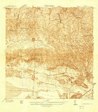
~ Sabana Grande PR topo map, 1:25000 scale, 7.5 X 7.5 Minute, Historical, 1937
Sabana Grande, Puerto Rico, USGS topographic map dated 1937.
Includes geographic coordinates (latitude and longitude). This topographic map is suitable for hiking, camping, and exploring, or framing it as a wall map.
Printed on-demand using high resolution imagery, on heavy weight and acid free paper, or alternatively on a variety of synthetic materials.
Topos available on paper, Waterproof, Poly, or Tyvek. Usually shipping rolled, unless combined with other folded maps in one order.
- Product Number: USGS-5686507
- Free digital map download (high-resolution, GeoPDF): Sabana Grande, Puerto Rico (file size: 15 MB)
- Map Size: please refer to the dimensions of the GeoPDF map above
- Weight (paper map): ca. 55 grams
- Map Type: POD USGS Topographic Map
- Map Series: HTMC
- Map Verison: Historical
- Cell ID: 39088
- Scan ID: 362307
- Survey Year: 1937
- Datum: Puerto Rico
- Map Projection: Polyconic
- Map published by United States Geological Survey
- Keywords: Overedge; Nonstandard Press Run
- Map Language: English
- Scanner Resolution: 600 dpi
- Map Cell Name: Sabana Grande
- Grid size: 7.5 X 7.5 Minute
- Date on map: 1937
- Map Scale: 1:25000
- Geographical region: Puerto Rico, United States
Neighboring Maps:
All neighboring USGS topo maps are available for sale online at a variety of scales.
Spatial coverage:
Topo map Sabana Grande, Puerto Rico, covers the geographical area associated the following places:
- Campamento Susúa - Arenas - Cañas - Lluveras - El Arrendado - Santa María - El Tumbao - Colinas de Villa Rosa - Minillas - Las Guaras - El Tumbao Comunidad - Liborio Negron Torres - Liborio Negrón Torres Comunidad - Alturas de San Jose - San Isidro - Lluveras Comunidad - La Pica - Susúa - Sabana Grande Zona Urbana - Magueyes - San Antonio - Sabana Grande - Boulevarda Machuchal - San Jose II - La Milagrosa - Sector Los Gardens - Residencial Jose Castillo Mercado - La Alborada - Fraternidad - Villa Alba - Machuchal
- Map Area ID: AREA18.12518-67-66.875
- Northwest corner Lat/Long code: USGSNW18.125-67
- Northeast corner Lat/Long code: USGSNE18.125-66.875
- Southwest corner Lat/Long code: USGSSW18-67
- Southeast corner Lat/Long code: USGSSE18-66.875
- Northern map edge Latitude: 18.125
- Southern map edge Latitude: 18
- Western map edge Longitude: -67
- Eastern map edge Longitude: -66.875


