
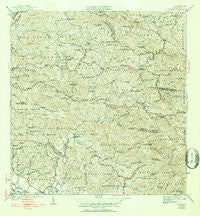
~ Rosario PR topo map, 1:30000 scale, 7.5 X 7.5 Minute, Historical, 1941, updated 1952
Rosario, Puerto Rico, USGS topographic map dated 1941.
Includes geographic coordinates (latitude and longitude). This topographic map is suitable for hiking, camping, and exploring, or framing it as a wall map.
Printed on-demand using high resolution imagery, on heavy weight and acid free paper, or alternatively on a variety of synthetic materials.
Topos available on paper, Waterproof, Poly, or Tyvek. Usually shipping rolled, unless combined with other folded maps in one order.
- Product Number: USGS-5655528
- Free digital map download (high-resolution, GeoPDF): Rosario, Puerto Rico (file size: 12 MB)
- Map Size: please refer to the dimensions of the GeoPDF map above
- Weight (paper map): ca. 55 grams
- Map Type: POD USGS Topographic Map
- Map Series: HTMC
- Map Verison: Historical
- Cell ID: 76918
- Scan ID: 362566
- Imprint Year: 1952
- Edit Year: 1949
- Survey Year: 1939
- Datum: Puerto Rico
- Map Projection: Polyconic
- Map published by United States Geological Survey
- Map Language: English
- Scanner Resolution: 600 dpi
- Map Cell Name: Rosario
- Grid size: 7.5 X 7.5 Minute
- Date on map: 1941
- Map Scale: 1:30000
- Geographical region: Puerto Rico, United States
Neighboring Maps:
All neighboring USGS topo maps are available for sale online at a variety of scales.
Spatial coverage:
Topo map Rosario, Puerto Rico, covers the geographical area associated the following places:
- El Cinco - Hormigueros Zona Urbana - Las Vegas - Finca La Corza - Ville India - Hacienda Esperanza - Hacienda Recurso - Limón - Hacienda Polmares - Hacienda La Milagrosa - Hacienda Retiro - San Agustín - Ponce de Leon - Finca Marini - Hacienda Córcega - Hacienda Salomé - Pico - Hacienda Veremos - Rosario - Hacienda Merle - Hacienda Bermúdez - Minima Verdum - Hacienda Fajardo - Consumo - Hacienda Cipriano - Villa Benni - Hacienda Juanita - Hacienda Rolón - Lavadero - Colinas del Oeste - Hacienda Constanza - Hacienda Plato Indio
- Map Area ID: AREA18.2518.125-67.125-67
- Northwest corner Lat/Long code: USGSNW18.25-67.125
- Northeast corner Lat/Long code: USGSNE18.25-67
- Southwest corner Lat/Long code: USGSSW18.125-67.125
- Southeast corner Lat/Long code: USGSSE18.125-67
- Northern map edge Latitude: 18.25
- Southern map edge Latitude: 18.125
- Western map edge Longitude: -67.125
- Eastern map edge Longitude: -67


