
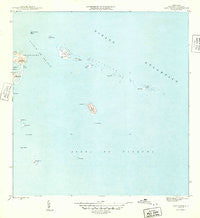
~ Cayo Icacos PR topo map, 1:30000 scale, 7.5 X 7.5 Minute, Historical, 1945
Cayo Icacos, Puerto Rico, USGS topographic map dated 1945.
Includes geographic coordinates (latitude and longitude). This topographic map is suitable for hiking, camping, and exploring, or framing it as a wall map.
Printed on-demand using high resolution imagery, on heavy weight and acid free paper, or alternatively on a variety of synthetic materials.
Topos available on paper, Waterproof, Poly, or Tyvek. Usually shipping rolled, unless combined with other folded maps in one order.
- Product Number: USGS-5655206
- Free digital map download (high-resolution, GeoPDF): Cayo Icacos, Puerto Rico (file size: 9 MB)
- Map Size: please refer to the dimensions of the GeoPDF map above
- Weight (paper map): ca. 55 grams
- Map Type: POD USGS Topographic Map
- Map Series: HTMC
- Map Verison: Historical
- Cell ID: 7739
- Scan ID: 362370
- Datum: Puerto Rico
- Map Projection: Polyconic
- Map published by United States Geological Survey
- Map Language: English
- Scanner Resolution: 600 dpi
- Map Cell Name: Cayo Icacos
- Grid size: 7.5 X 7.5 Minute
- Date on map: 1945
- Map Scale: 1:30000
- Geographical region: Puerto Rico, United States
Neighboring Maps:
All neighboring USGS topo maps are available for sale online at a variety of scales.
Spatial coverage:
Topo map Cayo Icacos, Puerto Rico, covers the geographical area associated the following places:
- Cayo Largo - Isla Palominitos - Arrecife Corona Carrillo - Isla de Ramos - Los Farallones - La Cordillera - Cayo Ratones - Cayo Lobos - Faro de Cabo San Juan - Arrecife Mata Caballos - Cayo Diablo - Bajo Laja - Cayo Icacos - Cabezas de San Juan - Playa Canalejo - Las Cucarachas - Pasaje Cucaracha - Arrecife Roncador - Cayos de la Cordillera Nature Reserve - Cayo Ahogado - Fajardo Harbor Seaplane Base - Rada Fajardo - La Blanquilla - Isleta Marina - Fajardo Municipio - Punta Mata Redonda - Pasaje de San Juan - Punta Aguila - Cabezas Barrio - Isla Palominos - Bajo Blake - Laguna Grande
- Map Area ID: AREA18.416666718.2916667-65.625-65.5
- Northwest corner Lat/Long code: USGSNW18.4166667-65.625
- Northeast corner Lat/Long code: USGSNE18.4166667-65.5
- Southwest corner Lat/Long code: USGSSW18.2916667-65.625
- Southeast corner Lat/Long code: USGSSE18.2916667-65.5
- Northern map edge Latitude: 18.4166667
- Southern map edge Latitude: 18.2916667
- Western map edge Longitude: -65.625
- Eastern map edge Longitude: -65.5


