
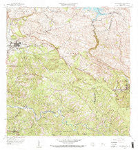
~ San Sebastian PR topo map, 1:20000 scale, 7.5 X 7.5 Minute, Historical, 1958, updated 1968
San Sebastian, Puerto Rico, USGS topographic map dated 1958.
Includes geographic coordinates (latitude and longitude). This topographic map is suitable for hiking, camping, and exploring, or framing it as a wall map.
Printed on-demand using high resolution imagery, on heavy weight and acid free paper, or alternatively on a variety of synthetic materials.
Topos available on paper, Waterproof, Poly, or Tyvek. Usually shipping rolled, unless combined with other folded maps in one order.
- Product Number: USGS-5655040
- Free digital map download (high-resolution, GeoPDF): San Sebastian, Puerto Rico (file size: 25 MB)
- Map Size: please refer to the dimensions of the GeoPDF map above
- Weight (paper map): ca. 55 grams
- Map Type: POD USGS Topographic Map
- Map Series: HTMC
- Map Verison: Historical
- Cell ID: 39708
- Scan ID: 362274
- Imprint Year: 1968
- Woodland Tint: Yes
- Visual Version Number: 1
- Edit Year: 1958
- Survey Year: 1938
- Datum: Puerto Rico
- Map Projection: Polyconic
- Map published by United States Geological Survey
- Map Language: English
- Scanner Resolution: 600 dpi
- Map Cell Name: San Sebastian
- Grid size: 7.5 X 7.5 Minute
- Date on map: 1958
- Map Scale: 1:20000
- Geographical region: Puerto Rico, United States
Neighboring Maps:
All neighboring USGS topo maps are available for sale online at a variety of scales.
Spatial coverage:
Topo map San Sebastian, Puerto Rico, covers the geographical area associated the following places:
- Juncal - La González - Sector Arizon - Acevedo - Hacienda San Pedro - Pedro Tomas La Valle - Lares - Campamento Guajataca - Tabonuco - Perchas - Reparto Roman - San Sebastián Zona Urbana - Las Marías - Barriada Chinto Rodon - Juncal Comunidad - Emerito Estra da Rivera - Jardines de Lares - Residencial Francisco Sein - El Guayabal - Muñoz Torruellas - San Sebastián - Sector Rafael Castro - Hacienda Canabal (historical) - El Salto - Boulevardo Majadero - Buena Vista - El Culebrinas - Las Marías Zona Urbana - Pacalelo 38 - Hacienda Porvenir - Lares Zona Urbana - Sector Retiro - Jardines de Venturrini
- Map Area ID: AREA18.37518.25-67-66.875
- Northwest corner Lat/Long code: USGSNW18.375-67
- Northeast corner Lat/Long code: USGSNE18.375-66.875
- Southwest corner Lat/Long code: USGSSW18.25-67
- Southeast corner Lat/Long code: USGSSE18.25-66.875
- Northern map edge Latitude: 18.375
- Southern map edge Latitude: 18.25
- Western map edge Longitude: -67
- Eastern map edge Longitude: -66.875


