
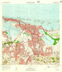
~ San Juan PR topo map, 1:20000 scale, 7.5 X 7.5 Minute, Historical, 1957, updated 1959
San Juan, Puerto Rico, USGS topographic map dated 1957.
Includes geographic coordinates (latitude and longitude). This topographic map is suitable for hiking, camping, and exploring, or framing it as a wall map.
Printed on-demand using high resolution imagery, on heavy weight and acid free paper, or alternatively on a variety of synthetic materials.
Topos available on paper, Waterproof, Poly, or Tyvek. Usually shipping rolled, unless combined with other folded maps in one order.
- Product Number: USGS-5655032
- Free digital map download (high-resolution, GeoPDF): San Juan, Puerto Rico (file size: 17 MB)
- Map Size: please refer to the dimensions of the GeoPDF map above
- Weight (paper map): ca. 55 grams
- Map Type: POD USGS Topographic Map
- Map Series: HTMC
- Map Verison: Historical
- Cell ID: 39644
- Scan ID: 362269
- Imprint Year: 1959
- Woodland Tint: Yes
- Edit Year: 1957
- Survey Year: 1940
- Datum: Puerto Rico
- Map Projection: Polyconic
- Map published by United States Geological Survey
- Map Language: English
- Scanner Resolution: 600 dpi
- Map Cell Name: San Juan
- Grid size: 7.5 X 7.5 Minute
- Date on map: 1957
- Map Scale: 1:20000
- Geographical region: Puerto Rico, United States
Neighboring Maps:
All neighboring USGS topo maps are available for sale online at a variety of scales.
Spatial coverage:
Topo map San Juan, Puerto Rico, covers the geographical area associated the following places:
- Floral Park - Garden Hills - Hill Brothers - Baldrich - Residencial El Mirador - Quintana - Villa Marina - Del Carmen - Villa Palmeras - Villa Prades - Reparto Sevilla - Guaynabo Zona Urbana - Villa Nevares - Villa Panamericana - Los Peñas - Lopez Sicardo - Town Park - San José - Berwind Estates - Villa Mar - Las Palmas - Bello Horizonte - Gardenville - Caparra Terrace - Davita y Llenza - Monteflores - La Riviera - Fuerte San Gerónimo - Obrero - Biascoechea - Vietnam - Manuel A Perez - Las Américas - Eleanor Roosevelt - Los Angeles - Villa Borinquen - Puerto Nuevo - Altamira - Valencia - Altamesa - Colinas Vendes - Jardines de Valencia - San Francisco - Parcelas Falú - Villas de Lago Mar - Tras Talleres - Venezuela - Nemesio Canales - El Vedado - Iturregui - Puerto Nuevo Norte - Luis Llorens Torres - Condado - San Juan Zona Urbana - Truman - Costa del Norte (historical) - Mansiones Monterrey - Monterrey - Highland Park - Buen Consejo - San Ramon - Sabana - Extension Las Casas - Laguna Gardens - Dos Pinos - Oasis Gardens - Reparto Universitario San Antonio - Gonzales Seijo - Hector A Piñero - Parque - El Viejo San Juan - Los Caobos - San Agustín - Parkside - Suchville - El Paradiso - Campo Rico - Las Casas - Residence San Juan Bautista - Villa Capri - Hyde Park - Puerto Nuevo Norte - Cayo Hueso - Rosendo Matienzo Cintron - Marruecos - Basilo Davila - Belisa - Residencial Luis Llorens Torres - Amelia - Jardines de Monte Hatillo - Victor Braegger - Santa Ana - Yambelle - San Juan - Concordia Gardens - Monte Bello - Reparto Universitario - Club Manor - Cambridge Park - College Park
- Map Area ID: AREA18.518.375-66.125-66
- Northwest corner Lat/Long code: USGSNW18.5-66.125
- Northeast corner Lat/Long code: USGSNE18.5-66
- Southwest corner Lat/Long code: USGSSW18.375-66.125
- Southeast corner Lat/Long code: USGSSE18.375-66
- Northern map edge Latitude: 18.5
- Southern map edge Latitude: 18.375
- Western map edge Longitude: -66.125
- Eastern map edge Longitude: -66


