
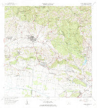
~ Sabana Grande PR topo map, 1:20000 scale, 7.5 X 7.5 Minute, Historical, 1966, updated 1969
Sabana Grande, Puerto Rico, USGS topographic map dated 1966.
Includes geographic coordinates (latitude and longitude). This topographic map is suitable for hiking, camping, and exploring, or framing it as a wall map.
Printed on-demand using high resolution imagery, on heavy weight and acid free paper, or alternatively on a variety of synthetic materials.
Topos available on paper, Waterproof, Poly, or Tyvek. Usually shipping rolled, unless combined with other folded maps in one order.
- Product Number: USGS-5655002
- Free digital map download (high-resolution, GeoPDF): Sabana Grande, Puerto Rico (file size: 20 MB)
- Map Size: please refer to the dimensions of the GeoPDF map above
- Weight (paper map): ca. 55 grams
- Map Type: POD USGS Topographic Map
- Map Series: HTMC
- Map Verison: Historical
- Cell ID: 39088
- Scan ID: 362252
- Imprint Year: 1969
- Woodland Tint: Yes
- Visual Version Number: 1
- Aerial Photo Year: 1963
- Field Check Year: 1966
- Survey Year: 1937
- Datum: Puerto Rico
- Map Projection: Polyconic
- Map published by United States Geological Survey
- Map Language: English
- Scanner Resolution: 600 dpi
- Map Cell Name: Sabana Grande
- Grid size: 7.5 X 7.5 Minute
- Date on map: 1966
- Map Scale: 1:20000
- Geographical region: Puerto Rico, United States
Neighboring Maps:
All neighboring USGS topo maps are available for sale online at a variety of scales.
Spatial coverage:
Topo map Sabana Grande, Puerto Rico, covers the geographical area associated the following places:
- Magueyes - La Alborada - Arenas - Liborio Negron Torres - Liborio Negrón Torres Comunidad - Campamento Susúa - San Antonio - Villa Alba - Las Guaras - El Tumbao - La Pica - Lluveras Comunidad - Sabana Grande - Colinas de Villa Rosa - El Arrendado - Cañas - Lluveras - San Isidro - Fraternidad - Susúa - Residencial Jose Castillo Mercado - Santa María - Machuchal - Sector Los Gardens - La Milagrosa - Alturas de San Jose - El Tumbao Comunidad - Sabana Grande Zona Urbana - San Jose II - Minillas - Boulevarda Machuchal
- Map Area ID: AREA18.12518-67-66.875
- Northwest corner Lat/Long code: USGSNW18.125-67
- Northeast corner Lat/Long code: USGSNE18.125-66.875
- Southwest corner Lat/Long code: USGSSW18-67
- Southeast corner Lat/Long code: USGSSE18-66.875
- Northern map edge Latitude: 18.125
- Southern map edge Latitude: 18
- Western map edge Longitude: -67
- Eastern map edge Longitude: -66.875


