
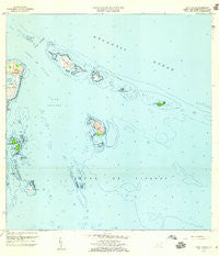
~ Cayo Icacos PR topo map, 1:20000 scale, 7.5 X 7.5 Minute, Historical, 1958, updated 1960
Cayo Icacos, Puerto Rico, USGS topographic map dated 1958.
Includes geographic coordinates (latitude and longitude). This topographic map is suitable for hiking, camping, and exploring, or framing it as a wall map.
Printed on-demand using high resolution imagery, on heavy weight and acid free paper, or alternatively on a variety of synthetic materials.
Topos available on paper, Waterproof, Poly, or Tyvek. Usually shipping rolled, unless combined with other folded maps in one order.
- Product Number: USGS-5654664
- Free digital map download (high-resolution, GeoPDF): Cayo Icacos, Puerto Rico (file size: 9 MB)
- Map Size: please refer to the dimensions of the GeoPDF map above
- Weight (paper map): ca. 55 grams
- Map Type: POD USGS Topographic Map
- Map Series: HTMC
- Map Verison: Historical
- Cell ID: 7739
- Scan ID: 362076
- Imprint Year: 1960
- Woodland Tint: Yes
- Aerial Photo Year: 1941
- Edit Year: 1958
- Field Check Year: 1943
- Datum: Puerto Rico
- Map Projection: Polyconic
- Map published by United States Geological Survey
- Map Language: English
- Scanner Resolution: 600 dpi
- Map Cell Name: Cayo Icacos
- Grid size: 7.5 X 7.5 Minute
- Date on map: 1958
- Map Scale: 1:20000
- Geographical region: Puerto Rico, United States
Neighboring Maps:
All neighboring USGS topo maps are available for sale online at a variety of scales.
Spatial coverage:
Topo map Cayo Icacos, Puerto Rico, covers the geographical area associated the following places:
- Bajo Laja - Isla Palominos - Cabezas Barrio - Las Cucarachas - Los Farallones - Isla Palominitos - Arrecife Roncador - Cabezas de San Juan - Punta Aguila - Isla de Ramos - Cayo Icacos - Arrecife Mata Caballos - Faro de Cabo San Juan - Fajardo Municipio - Arrecife Corona Carrillo - Pasaje Cucaracha - Pasaje de San Juan - Fajardo Harbor Seaplane Base - Rada Fajardo - La Cordillera - La Blanquilla - Cayo Ahogado - Isleta Marina - Cayo Ratones - Punta Mata Redonda - Bajo Blake - Cayo Diablo - Cayos de la Cordillera Nature Reserve - Cayo Lobos - Playa Canalejo - Cayo Largo - Laguna Grande
- Map Area ID: AREA18.416666718.2916667-65.625-65.5
- Northwest corner Lat/Long code: USGSNW18.4166667-65.625
- Northeast corner Lat/Long code: USGSNE18.4166667-65.5
- Southwest corner Lat/Long code: USGSSW18.2916667-65.625
- Southeast corner Lat/Long code: USGSSE18.2916667-65.5
- Northern map edge Latitude: 18.4166667
- Southern map edge Latitude: 18.2916667
- Western map edge Longitude: -65.625
- Eastern map edge Longitude: -65.5


