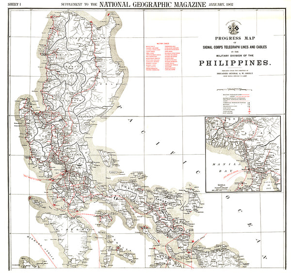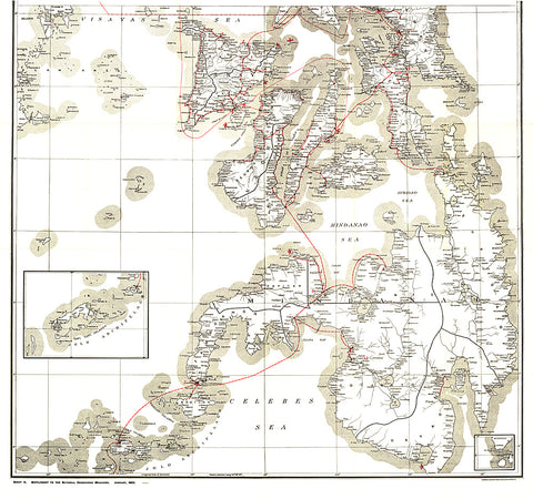
1902 Philippines Military Telegraph Lines South Map
This map was produced in astonishing detail as a supplement to the January, 1902 National Geographic Magazine, and accompanies the northern Philippine Islands map. Just four years earlier, the United States purchased the rights to the territory from Spain for $20,000,000, and this beautiful map shows the entire group of islands, along with a detailed inset of the Manila Bay area. Anyone interested in history or the Far East will find this map to be an excellent addition to your map collection.
- Product Number: PODHNG_PHIL_MIL_S_02
- Reference Product Number: 2321353M
- ISBN: - None -
- Date of Publication: 6/1/1902
- Unfolded (flat) Size: 33.75 inches high by 36 inches wide
- Map format: Wall
- Map type: Trade Maps - Historical
- Geographical region: Philippines