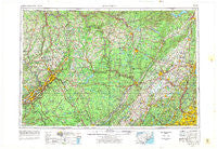
~ Scranton PA topo map, 1:250000 scale, 1 X 2 Degree, Historical, 1962, updated 1977
Scranton, Pennsylvania, USGS topographic map dated 1962.
Includes geographic coordinates (latitude and longitude). This topographic map is suitable for hiking, camping, and exploring, or framing it as a wall map.
Printed on-demand using high resolution imagery, on heavy weight and acid free paper, or alternatively on a variety of synthetic materials.
Topos available on paper, Waterproof, Poly, or Tyvek. Usually shipping rolled, unless combined with other folded maps in one order.
- Product Number: USGS-5332066
- Free digital map download (high-resolution, GeoPDF): Scranton, Pennsylvania (file size: 16 MB)
- Map Size: please refer to the dimensions of the GeoPDF map above
- Weight (paper map): ca. 55 grams
- Map Type: POD USGS Topographic Map
- Map Series: HTMC
- Map Verison: Historical
- Cell ID: 69021
- Scan ID: 707602
- Imprint Year: 1977
- Woodland Tint: Yes
- Aerial Photo Year: 1974
- Edit Year: 1976
- Field Check Year: 1962
- Datum: Unstated
- Map Projection: Transverse Mercator
- Map published by United States Geological Survey
- Map Language: English
- Scanner Resolution: 508 dpi
- Map Cell Name: Scranton
- Grid size: 1 X 2 Degree
- Date on map: 1962
- Map Scale: 1:250000
- Geographical region: Pennsylvania, United States
Neighboring Maps:
All neighboring USGS topo maps are available for sale online at a variety of scales.
Spatial coverage:
Topo map Scranton, Pennsylvania, covers the geographical area associated the following places:
- Haven - West Falls - Meadow Winds - Sundown - Darbytown - Middletown - Blue Sky Manor Mobile Home Park - Roys - Marbletown - Whiteport - Durland - Moscow - Taylor - Wild Acres - Rudes Corner - Halihan Hill - Rita - Plumbsock - Steene - West Lenox - Tannersville - Abertown - Middleburg - Lackawaxen - Trucksville - Franklin - Auburn Four Corners - Plutarch - Jenkinstown - Morrison Heights - Lakeville - Mamakating Park - Lake Carey - Echo Lake - Elk Brook - Whitfield - Basket - Winona Lakes - Upper Mongaup - Old Orchard Trailer Park - Mahola - Harford - Providence - Wyoming - Dogwood Hills - Sugar Loaf - Aberdeen - Red Ledge Manor Estates - Indian Park - Creek Locks Mobile Home Park - Canterbury Knolls - Hankins - Pacatacan (historical) - Stanfordville - Downey Farms - Carpenter Hollow - Fox Hill - Upper Beechwood - Mount Zion - Roosa Gap - Russia - Liberty - Quinns Corner - Little Britain - Hillsdale - Pine Flats - Montgomery - Mushroom Farms - Riverside Park - Erskine Lakes - Fostertown - Schultzville - Browntown - Varden - Mount Vernon - Tamiment - Ledgedale - Forest Lake Park - Hillside - Ogdensburg - Sterling Forest - Herrick Center - Vails Gate - Mongaup Valley - Montrose - Crandon Lakes - Blakeslee Estates - La Anna - Beaverkill - Choconut - Greenville - Dashville - Davenport - Johnson Greene - Clarks Green - Scranton - Parish Lane Mobile Home Park - Dunmore - Lomontville - Spring Valley
- Map Area ID: AREA4241-76-74
- Northwest corner Lat/Long code: USGSNW42-76
- Northeast corner Lat/Long code: USGSNE42-74
- Southwest corner Lat/Long code: USGSSW41-76
- Southeast corner Lat/Long code: USGSSE41-74
- Northern map edge Latitude: 42
- Southern map edge Latitude: 41
- Western map edge Longitude: -76
- Eastern map edge Longitude: -74

