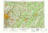
~ Pittsburgh PA topo map, 1:250000 scale, 1 X 2 Degree, Historical, 1958
Pittsburgh, Pennsylvania, USGS topographic map dated 1958.
Includes geographic coordinates (latitude and longitude). This topographic map is suitable for hiking, camping, and exploring, or framing it as a wall map.
Printed on-demand using high resolution imagery, on heavy weight and acid free paper, or alternatively on a variety of synthetic materials.
Topos available on paper, Waterproof, Poly, or Tyvek. Usually shipping rolled, unless combined with other folded maps in one order.
- Product Number: USGS-5332052
- Free digital map download (high-resolution, GeoPDF): Pittsburgh, Pennsylvania (file size: 21 MB)
- Map Size: please refer to the dimensions of the GeoPDF map above
- Weight (paper map): ca. 55 grams
- Map Type: POD USGS Topographic Map
- Map Series: HTMC
- Map Verison: Historical
- Cell ID: 68961
- Scan ID: 221430
- Woodland Tint: Yes
- Photo Inspection Year: 1971
- Aerial Photo Year: 1958
- Edit Year: 1969
- Datum: Unstated
- Map Projection: Transverse Mercator
- Map published by: Military, Other
- Map Language: English
- Scanner Resolution: 600 dpi
- Map Cell Name: Pittsburgh
- Grid size: 1 X 2 Degree
- Date on map: 1958
- Map Scale: 1:250000
- Geographical region: Pennsylvania, United States
Neighboring Maps:
All neighboring USGS topo maps are available for sale online at a variety of scales.
Spatial coverage:
Topo map Pittsburgh, Pennsylvania, covers the geographical area associated the following places:
- Schenley - Carbon Center - Wallaceton - Floreffe - Martha Furnace - Alcoa Center - Reservoir - Fairhope - Fox Chapel - Yellow Spring - Byers Corner - Craigsville - Charlies Grove - Atlantic - Frazier Mill - Penn Run - Boardman - Beatty - Highfield - Patterson Hill - Edmon - McGrann - West Elizabeth - Alfarata - Meadowdale - Ostend - Hickory Hill - Churchill - North Butler - Edgecliff - Maple Grove - Suncliff - Newell - Shadyside Village - Dias - Nellie - Reightown - Old Mountain House - Fellsburg - Freeport - Earlston - Mahaffey - Amsbry - Knightsville - Arona - Claridge - Juniata - Bridgeport - Wadsworth - Daisytown - Fairview - Lauffer - Blue Knob - Long Branch - Moween - Pemberton - Schellsburg - Brentwood - West Vandergrift - Radebaugh - Crescent Hills - Universal - Frogtown - Charlestown - Echo - Lowber - Mount Vernon - New Washington - Cairnbrook - Brinkerton - Cummingswood Park - Kennywood Park - Fisher - Darlington - Century - Indian Head - Vinco - Pavia - West Derry - Overbrook - Neale - Liberty - Ginter - Frick Park - Newtown - Pinetree - Leak Run - Hamilton - Clover Hill - Reagantown - Sistersville - East Butler - Hustontown - Camden - Llyswen - Point View - Elkin - Waterside - Allens Crossroads - Stumptown
- Map Area ID: AREA4140-80-78
- Northwest corner Lat/Long code: USGSNW41-80
- Northeast corner Lat/Long code: USGSNE41-78
- Southwest corner Lat/Long code: USGSSW40-80
- Southeast corner Lat/Long code: USGSSE40-78
- Northern map edge Latitude: 41
- Southern map edge Latitude: 40
- Western map edge Longitude: -80
- Eastern map edge Longitude: -78

