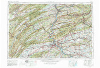
~ Harrisburg PA topo map, 1:250000 scale, 1 X 2 Degree, Historical, 1957
Harrisburg, Pennsylvania, USGS topographic map dated 1957.
Includes geographic coordinates (latitude and longitude). This topographic map is suitable for hiking, camping, and exploring, or framing it as a wall map.
Printed on-demand using high resolution imagery, on heavy weight and acid free paper, or alternatively on a variety of synthetic materials.
Topos available on paper, Waterproof, Poly, or Tyvek. Usually shipping rolled, unless combined with other folded maps in one order.
- Product Number: USGS-5332036
- Free digital map download (high-resolution, GeoPDF): Harrisburg, Pennsylvania (file size: 22 MB)
- Map Size: please refer to the dimensions of the GeoPDF map above
- Weight (paper map): ca. 55 grams
- Map Type: POD USGS Topographic Map
- Map Series: HTMC
- Map Verison: Historical
- Cell ID: 68815
- Scan ID: 223162
- Woodland Tint: Yes
- Visual Version Number: 1
- Photo Revision Year: 1969
- Aerial Photo Year: 1952
- Field Check Year: 1957
- Datum: NAD27
- Map Projection: Transverse Mercator
- Map published by: Military, Other
- Map Language: English
- Scanner Resolution: 600 dpi
- Map Cell Name: Harrisburg
- Grid size: 1 X 2 Degree
- Date on map: 1957
- Map Scale: 1:250000
- Geographical region: Pennsylvania, United States
Neighboring Maps:
All neighboring USGS topo maps are available for sale online at a variety of scales.
Spatial coverage:
Topo map Harrisburg, Pennsylvania, covers the geographical area associated the following places:
- Country Ridge Estates - Pine Grove - Intercourse - Mount Allen Estates - Walnut Grove - Fertility - Erney - Inwood - Rossmoyne - Greason - Kreamer - Cherry Run - Nuremberg - Unionville - Helfenstein - Hamilton - Wago Junction - Progress - Wilshire Hills - Cameron - Hosensock - Mexico - Dellville - Bamford - Center Union - Big Mine Run - Kulpmont - Roseann - Milroy - Buffalo Crossroads - West Lampeter - Mount Carmel Junction - Belmont - Cuba Mills - Remeos Mobile Home Park - Colonial Wood - Woodward - Sinking Spring - Turkey Run - Nook - Homewood - Zerbe - Moonstown - Tannertown - Peace Church - Fruitville - Hawstone - Harris Acres - Willow Lake - Gordonville - Penn Hall - Mount Pleasant - Lebanon Independent - Rockford Heights - Belmont Acres - New Mines - Midway - Emigsville - Little Kansas - Mongul - Kerrsville - Fox Chase - Westwood Village - Kralltown - McGillstown - Haas - Neffsville - Quaker Hills - Dale Summit - Parrs Mill - Holmstead Manor - Clearview - Goodville - Le High Park - Irving - Whitfield - Freys Grove - Greenfield - Rushtown - Fruittown - Valley Green - Carsonville - Old Colonial Village - Newville - Ranshaw - Howell - Ridgemont - Shoentown - Conewago Heights - East Petersburg - Couchtown - Sunset Manor - Franklintown - McAlevys Fort - Belleville - Kipps Run - Mahanoy Plane - Laurelton - Bareville - Buck Mountain
- Map Area ID: AREA4140-78-76
- Northwest corner Lat/Long code: USGSNW41-78
- Northeast corner Lat/Long code: USGSNE41-76
- Southwest corner Lat/Long code: USGSSW40-78
- Southeast corner Lat/Long code: USGSSE40-76
- Northern map edge Latitude: 41
- Southern map edge Latitude: 40
- Western map edge Longitude: -78
- Eastern map edge Longitude: -76

