
~ Harrisburg PA topo map, 1:250000 scale, 1 X 2 Degree, Historical, 1961, updated 1961
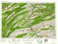
Harrisburg, Pennsylvania, USGS topographic map dated 1961.
Includes geographic coordinates (latitude and longitude). This topographic map is suitable for hiking, camping, and exploring, or framing it as a wall map.
Printed on-demand using high resolution imagery, on heavy weight and acid free paper, or alternatively on a variety of synthetic materials.
Topos available on paper, Waterproof, Poly, or Tyvek. Usually shipping rolled, unless combined with other folded maps in one order.
- Product Number: USGS-5332026
- Free digital map download (high-resolution, GeoPDF): Harrisburg, Pennsylvania (file size: 20 MB)
- Map Size: please refer to the dimensions of the GeoPDF map above
- Weight (paper map): ca. 55 grams
- Map Type: POD USGS Topographic Map
- Map Series: HTMC
- Map Verison: Historical
- Cell ID: 68815
- Scan ID: 171809
- Imprint Year: 1961
- Woodland Tint: Yes
- Field Check Year: 1957
- Datum: Unstated
- Map Projection: Transverse Mercator
- Map published by United States Army Corps of Engineers
- Map published by United States Army
- Map Language: English
- Scanner Resolution: 600 dpi
- Map Cell Name: Harrisburg
- Grid size: 1 X 2 Degree
- Date on map: 1961
- Map Scale: 1:250000
- Geographical region: Pennsylvania, United States
Neighboring Maps:
All neighboring USGS topo maps are available for sale online at a variety of scales.
Spatial coverage:
Topo map Harrisburg, Pennsylvania, covers the geographical area associated the following places:
- Smullton - Cacoosing - Marysville - Old Fort - Kistler - Greenland - Goodville - Orwin - Mechanicsburg - Mahanoy City - Beverly Estates - Bannerville - McKeansburg - Toftrees - Benedicts - Phoenix Park - Frysville - Nantilly - Winfield - Keefers - Colonial Park - Dover - Enola - Hazleton Junction - Colonial Hills - Pleasant Hills - Queen City - Kissimmee - Mount Patrick - Lykens - Port Ann - Mechanicsville - Highmount - Shawnee - Murrell - Soradoville - White Rock Acres - McCoysville - Marene Village - English Manor - Halifax - South Devonshire Estates - Florys Mill - Cocalico - Stanhope - Syner - Wolfs Store - Shady Acres - Kralltown - Fairview Park - Ferndale - Colonial Estates - Cameron - Springville - New Germantown - Sand Hill - Cartin - Fort Couch - Park Crest - Bunker Hill - Lewisberry - Mill Creek - Wynn Wood Manor - Pfoutz Valley - Shreiners - Wheatland - Manor Ridge - Talmage - Powells Valley - Hoffer - Coal Run - Excelsior - Mastersonville - Dickinson - Middleport - Williams Grove - Fox Chase - Pleasant View - Roedersville - Kaska - Highland Park - Juniata Furnace - Pine Grove Mills - Zerby - Sporting Hill - Parrs Mill - Siglerville - Stony Creek - Pleasant Hall - Eubuna Gardens - Mount Carbon - Penryn - Zooks Corner - Haucks - Knob Point - Garden Hills - Adams - Mazeppa - Progress - Park Place Townhouses
- Map Area ID: AREA4140-78-76
- Northwest corner Lat/Long code: USGSNW41-78
- Northeast corner Lat/Long code: USGSNE41-76
- Southwest corner Lat/Long code: USGSSW40-78
- Southeast corner Lat/Long code: USGSSE40-76
- Northern map edge Latitude: 41
- Southern map edge Latitude: 40
- Western map edge Longitude: -78
- Eastern map edge Longitude: -76


