
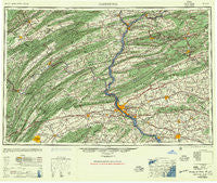
~ Harrisburg PA topo map, 1:250000 scale, 1 X 2 Degree, Historical, 1957, updated 1957
Harrisburg, Pennsylvania, USGS topographic map dated 1957.
Includes geographic coordinates (latitude and longitude). This topographic map is suitable for hiking, camping, and exploring, or framing it as a wall map.
Printed on-demand using high resolution imagery, on heavy weight and acid free paper, or alternatively on a variety of synthetic materials.
Topos available on paper, Waterproof, Poly, or Tyvek. Usually shipping rolled, unless combined with other folded maps in one order.
- Product Number: USGS-5332024
- Free digital map download (high-resolution, GeoPDF): Harrisburg, Pennsylvania (file size: 20 MB)
- Map Size: please refer to the dimensions of the GeoPDF map above
- Weight (paper map): ca. 55 grams
- Map Type: POD USGS Topographic Map
- Map Series: HTMC
- Map Verison: Historical
- Cell ID: 68815
- Scan ID: 171800
- Imprint Year: 1957
- Woodland Tint: Yes
- Aerial Photo Year: 1939
- Datum: NAD27
- Map Projection: Transverse Mercator
- Map published by United States Army Corps of Engineers
- Map published by United States Army
- Map Language: English
- Scanner Resolution: 600 dpi
- Map Cell Name: Harrisburg
- Grid size: 1 X 2 Degree
- Date on map: 1957
- Map Scale: 1:250000
- Geographical region: Pennsylvania, United States
Neighboring Maps:
All neighboring USGS topo maps are available for sale online at a variety of scales.
Spatial coverage:
Topo map Harrisburg, Pennsylvania, covers the geographical area associated the following places:
- Fort Couch - Leola - Long Lane Acres - Kehler - Hawstone - Airydale - Rockville - Marshallton - Roxbury - Gowen - Mount Gretna - Sinking Spring Terrace - Keystone - Nyesville - Spring Valley - Locust Run - Haucks - Donegal Heights - Bernville - Winfield - New Berlin - Mechanicsburg - Bellegrove - Ridgeview - Buck Mountain - Colonial Park - Newlin - Kaseville - Newville - Farmers Mills - Phoebe Berks Village - Uno - Glades - Pine Grove Furnace - Shawnee - Deardorffs Mill - Knobville - Zerbe - Shirleysburg - Wahneta - Hartleton - Oak Hall - Mountain View Acres - Hollars Hill - Coal Run - Highland Park - Evendale - Anderson - Joliett - Mount Hope - Spring Creek Manor - Kneass - Shiremanstown - Dykeman Spring - Eastland Hills - Liebys Trailer Park - Green Valley Estates - Knoebels Grove - Enola - Yarnell - Middleport - Raricks - Good Hope - Trevorton - Hillsdale Acres - Klingerstown - Laurel Junction - Vira - Tuscarora - Clear Spring - Carrick Valley - Wetherill Junction - Snydertown - Mongul - Pine Junction - Kingtown - Harristown - Homeland - Dayton - Powells Valley - Coffeetown - Cottage - Ravine - Bunker Hill - Kellerville - Hepler - Vulcan - Quaker Hills - Suedberg - Madisonburg - Tusculum - Plainfield - West Lancaster - Ryeland - Leacock - Bellefonte - Tannertown - Mahantango - Forest - Maitland
- Map Area ID: AREA4140-78-76
- Northwest corner Lat/Long code: USGSNW41-78
- Northeast corner Lat/Long code: USGSNE41-76
- Southwest corner Lat/Long code: USGSSW40-78
- Southeast corner Lat/Long code: USGSSE40-76
- Northern map edge Latitude: 41
- Southern map edge Latitude: 40
- Western map edge Longitude: -78
- Eastern map edge Longitude: -76


