
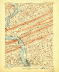
~ Harrisburg PA topo map, 1:62500 scale, 15 X 15 Minute, Historical, 1899, updated 1906
Harrisburg, Pennsylvania, USGS topographic map dated 1899.
Includes geographic coordinates (latitude and longitude). This topographic map is suitable for hiking, camping, and exploring, or framing it as a wall map.
Printed on-demand using high resolution imagery, on heavy weight and acid free paper, or alternatively on a variety of synthetic materials.
Topos available on paper, Waterproof, Poly, or Tyvek. Usually shipping rolled, unless combined with other folded maps in one order.
- Product Number: USGS-5330244
- Free digital map download (high-resolution, GeoPDF): Harrisburg, Pennsylvania (file size: 10 MB)
- Map Size: please refer to the dimensions of the GeoPDF map above
- Weight (paper map): ca. 55 grams
- Map Type: POD USGS Topographic Map
- Map Series: HTMC
- Map Verison: Historical
- Cell ID: 55090
- Scan ID: 167839
- Imprint Year: 1906
- Survey Year: 1890
- Datum: Unstated
- Map Projection: Unstated
- Map published by United States Geological Survey
- Map Language: English
- Scanner Resolution: 600 dpi
- Map Cell Name: Harrisburg
- Grid size: 15 X 15 Minute
- Date on map: 1899
- Map Scale: 1:62500
- Geographical region: Pennsylvania, United States
Neighboring Maps:
All neighboring USGS topo maps are available for sale online at a variety of scales.
Spatial coverage:
Topo map Harrisburg, Pennsylvania, covers the geographical area associated the following places:
- Hassler Meadows - Oakleigh - Lawnford Acres - Matamoras - Sparton Marshfield - Hodges Heights - Good Hope Mill - Rockford Heights - Haven Croft - Paxton Acres - Mountain View - Progress - Kingwood - Carsonville - Colonial Hills - New Buffalo - Pleasant Hills - Club Estates - Devonshire Hills - Lakeview Heights - Beaufort Farms - Paxtang Manor - Chestnut Hill - Ridgeland - Fort Hunter - Rutherford Gardens - Heckton - Chartwood - Sherwood Park - Hanover Heights - Coxtown (historical) - Brandywine Manor - West Enola - Lucknow - Forest Hills - Colonial Terrace - White Spring - English Manor - Ridge Acres - Lawrence Park - Paxtonia - Speeceville - Mount View - Springford Village - Ellendale Forge - Locust Lane Acres - Hillside Village - Twin Lakes Park - Penbrook - Montgomery Ferry - Ridgeview - Marene Village - Rutherford - Colonial Estates - Belmont Acres - Centennial Acres - Glenwood - Summerdale - Fox Ridge Court - Paxton Hollow Estates - Sunset Manor - Colonial Park - Waynesville - Paxtang Manor - Knob Point - Good Hope - Clearview Manor - Beaver Brook Manor - Westwood Village - Rustic Hills - Bloomburg Village - Lawnton - Jackson Lick - Colonial Wood - Spring Valley - Susquehanna Manor - Bonneymeade Farm - Devonshire Heights - Lawton Gardens - Colonial Park Farms - Singersville - Coventry Close - Mountain View Acres - South Devonshire Estates - Devonshire Estates - Hampden Village Mobile Home Park - West Creek Hills - Colonial Crest - Twin Lakes - Mountain Dale - Mountain View Estates - Harrisburg - Treemont - Glenvale - Wormleysburg - Enola - Eubuna Gardens - Sangree - Paxtang - Holiday Park
- Map Area ID: AREA40.540.25-77-76.75
- Northwest corner Lat/Long code: USGSNW40.5-77
- Northeast corner Lat/Long code: USGSNE40.5-76.75
- Southwest corner Lat/Long code: USGSSW40.25-77
- Southeast corner Lat/Long code: USGSSE40.25-76.75
- Northern map edge Latitude: 40.5
- Southern map edge Latitude: 40.25
- Western map edge Longitude: -77
- Eastern map edge Longitude: -76.75


