
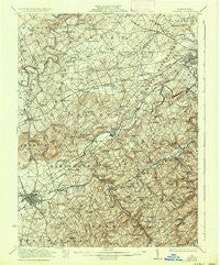
~ Hanover PA topo map, 1:62500 scale, 15 X 15 Minute, Historical, 1922, updated 1937
Hanover, Pennsylvania, USGS topographic map dated 1922.
Includes geographic coordinates (latitude and longitude). This topographic map is suitable for hiking, camping, and exploring, or framing it as a wall map.
Printed on-demand using high resolution imagery, on heavy weight and acid free paper, or alternatively on a variety of synthetic materials.
Topos available on paper, Waterproof, Poly, or Tyvek. Usually shipping rolled, unless combined with other folded maps in one order.
- Product Number: USGS-5330238
- Free digital map download (high-resolution, GeoPDF): Hanover, Pennsylvania (file size: 9 MB)
- Map Size: please refer to the dimensions of the GeoPDF map above
- Weight (paper map): ca. 55 grams
- Map Type: POD USGS Topographic Map
- Map Series: HTMC
- Map Verison: Historical
- Cell ID: 55051
- Scan ID: 170737
- Imprint Year: 1937
- Survey Year: 1920
- Datum: NAD
- Map Projection: Polyconic
- Map published by United States Geological Survey
- Map Language: English
- Scanner Resolution: 600 dpi
- Map Cell Name: Hanover
- Grid size: 15 X 15 Minute
- Date on map: 1922
- Map Scale: 1:62500
- Geographical region: Pennsylvania, United States
Neighboring Maps:
All neighboring USGS topo maps are available for sale online at a variety of scales.
Spatial coverage:
Topo map Hanover, Pennsylvania, covers the geographical area associated the following places:
- Parkville - La Bott - Moulstown - Neiman - Porters Sideling - Iron Ridge - Graybill - Bair - Hanover - Gnatstown - Shiloh - East Berlin - Ambau - Fuhrmans Mill - Kraft Mill - Big Mount - Campbell Estates - Hanover Junction - Holly Heights - Taxville - Menges Mills - Weigelstown - West York - Foustown - Smiths Station - Jefferson - Larue - Fairway - Maple Grove - Fireside Park - Davidsburg - Botts - Mackey Ford - Lehman - New Salem - Greenbriar - Holtzswam - Admire - Seven Valleys - Pigeon Hills (historical) - New Baltimore - Valley Junction - Cold Spring - Brodbecks - Glatfelters - Farmers - Poplars - Marburg - Sinsheim - Blooming Grove - Stoverstown - Pennville - Penn Grove - Glenville - Jacobs Mills - Abbottstown - Pentland - Martin - Brillhart - Fordville - Pierceville - Strickhousers - Seitzville - Thomasville - Rockville - Bonnair - Spring Grove - Nashville
- Map Area ID: AREA4039.75-77-76.75
- Northwest corner Lat/Long code: USGSNW40-77
- Northeast corner Lat/Long code: USGSNE40-76.75
- Southwest corner Lat/Long code: USGSSW39.75-77
- Southeast corner Lat/Long code: USGSSE39.75-76.75
- Northern map edge Latitude: 40
- Southern map edge Latitude: 39.75
- Western map edge Longitude: -77
- Eastern map edge Longitude: -76.75


