
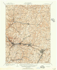
~ Greensburg PA topo map, 1:62500 scale, 15 X 15 Minute, Historical, 1906, updated 1951
Greensburg, Pennsylvania, USGS topographic map dated 1906.
Includes geographic coordinates (latitude and longitude). This topographic map is suitable for hiking, camping, and exploring, or framing it as a wall map.
Printed on-demand using high resolution imagery, on heavy weight and acid free paper, or alternatively on a variety of synthetic materials.
Topos available on paper, Waterproof, Poly, or Tyvek. Usually shipping rolled, unless combined with other folded maps in one order.
- Product Number: USGS-5330204
- Free digital map download (high-resolution, GeoPDF): Greensburg, Pennsylvania (file size: 11 MB)
- Map Size: please refer to the dimensions of the GeoPDF map above
- Weight (paper map): ca. 55 grams
- Map Type: POD USGS Topographic Map
- Map Series: HTMC
- Map Verison: Historical
- Cell ID: 54839
- Scan ID: 170833
- Imprint Year: 1951
- Survey Year: 1904
- Datum: NAD
- Map Projection: Polyconic
- Map published by United States Geological Survey
- Map Language: English
- Scanner Resolution: 600 dpi
- Map Cell Name: Greensburg
- Grid size: 15 X 15 Minute
- Date on map: 1906
- Map Scale: 1:62500
- Geographical region: Pennsylvania, United States
Neighboring Maps:
All neighboring USGS topo maps are available for sale online at a variety of scales.
Spatial coverage:
Topo map Greensburg, Pennsylvania, covers the geographical area associated the following places:
- Bovard - Delmont - Beech Hills - Stonevilla - Ringertown - Holiday Park - Fort Allen - Larimer - Jeannette - Greensburg - Saint Clair - Middletown - West Export - White Valley - Lincoln Heights - North Irwin - Edna Number One - Wiester - Arona - Scab Hill - Dick - Cereal - Franklin - Slickville - Manor - Dunningtown - McCullough - Barners Hill - Herminie Number 2 - Adamsburg - Millersdale - Grapeville - Fairmount - Renton Junction - Hahntown - Level Green - Penn - Murrysville - Fulton - Sardis - Southwest Greensburg - Evanstown - Westmoreland City - Five Points - Newlonsburg - Mamont - Harrison City - Forbes Road - Claridge - Sunset Valley - Jacktown - Edna Number Two - Ardara - Basforth Acres - Oakville - Keystone - Irwin - Penn Glyn - Circleville - Poke Run - Rillton - Shafton - Midway - Boquet - Wendel - Browntown - Export - Eastwood - Maplewood Terrace - Radebaugh - Pleasant Valley - South Greensburg - Shawtown - Trees Mills - Carbon - Herminie - Highland - Swede Hill - Congruity - Blackburn - Paintertown - Darragh
- Map Area ID: AREA40.540.25-79.75-79.5
- Northwest corner Lat/Long code: USGSNW40.5-79.75
- Northeast corner Lat/Long code: USGSNE40.5-79.5
- Southwest corner Lat/Long code: USGSSW40.25-79.75
- Southeast corner Lat/Long code: USGSSE40.25-79.5
- Northern map edge Latitude: 40.5
- Southern map edge Latitude: 40.25
- Western map edge Longitude: -79.75
- Eastern map edge Longitude: -79.5


