
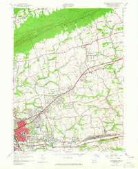
~ Harrisburg East PA topo map, 1:24000 scale, 7.5 X 7.5 Minute, Historical, 1947, updated 1965
Harrisburg East, Pennsylvania, USGS topographic map dated 1947.
Includes geographic coordinates (latitude and longitude). This topographic map is suitable for hiking, camping, and exploring, or framing it as a wall map.
Printed on-demand using high resolution imagery, on heavy weight and acid free paper, or alternatively on a variety of synthetic materials.
Topos available on paper, Waterproof, Poly, or Tyvek. Usually shipping rolled, unless combined with other folded maps in one order.
- Product Number: USGS-5324400
- Free digital map download (high-resolution, GeoPDF): Harrisburg East, Pennsylvania (file size: 10 MB)
- Map Size: please refer to the dimensions of the GeoPDF map above
- Weight (paper map): ca. 55 grams
- Map Type: POD USGS Topographic Map
- Map Series: HTMC
- Map Verison: Historical
- Cell ID: 19452
- Scan ID: 171780
- Imprint Year: 1965
- Woodland Tint: Yes
- Aerial Photo Year: 1942
- Field Check Year: 1947
- Datum: NAD27
- Map Projection: Polyconic
- Map published by United States Geological Survey
- Map published by United States Army Corps of Engineers
- Map published by United States Army
- Map Language: English
- Scanner Resolution: 600 dpi
- Map Cell Name: Harrisburg East
- Grid size: 7.5 X 7.5 Minute
- Date on map: 1947
- Map Scale: 1:24000
- Geographical region: Pennsylvania, United States
Neighboring Maps:
All neighboring USGS topo maps are available for sale online at a variety of scales.
Spatial coverage:
Topo map Harrisburg East, Pennsylvania, covers the geographical area associated the following places:
- Windsor Manor - Marene Village - Holiday Park - Locust Ridge Manor - Rutherford - Paxton Acres - Locust Lane Acres - Colonial Hills - Haven Croft - Paxtang - Paxtonia - Devonshire Estates - Colonial Park Farms - Oakleigh - Devonshire Hills - Poplar Gardens - Centennial Acres - Penbrook - Club Estates - Forest Hills - Mountain View - Springford Village - Blue Ridge Manor - Brandywine Manor - Belmont Acres - Hodges Heights - Lawrence Park - Rustic Hills - Vaughn - Colonial Terrace - Houck Manor - Lawnton - Twin Lakes Park - Clearview Manor - Pleasant Hills - Colonial Park - Hassler Meadows - Fox Chase - Lakeview Heights - Eubuna Gardens - Kent Gardens - Lawnford Acres - Sparton Marshfield - Beaver Brook Manor - Old Colonial Village - Holmstead Manor - Bloomburg Village - David Manor - Sangree - Hanover Heights - Paxtang Manor - Rutherford Gardens - Colonial Crest - Ridge Acres - Rockford Heights - Ridgeview - Glenwood - Progress - Colonial Estates - Catalina - Bonneymeade Farm - Lawton Gardens - Rutherford Heights - Susquehanna Manor - Colonial Wood - English Manor - Woodridge Estates - South Devonshire Estates - Pennwood - Paxton Hollow Estates - Chestnut Hill - Linglestown - Paxtang Manor - Twin Lakes - Chartwood - Devonshire Heights - Spring Valley - Mountain View Acres - Locust Lane Gardens - Edgemont - Sunset Manor
- Map Area ID: AREA40.37540.25-76.875-76.75
- Northwest corner Lat/Long code: USGSNW40.375-76.875
- Northeast corner Lat/Long code: USGSNE40.375-76.75
- Southwest corner Lat/Long code: USGSSW40.25-76.875
- Southeast corner Lat/Long code: USGSSE40.25-76.75
- Northern map edge Latitude: 40.375
- Southern map edge Latitude: 40.25
- Western map edge Longitude: -76.875
- Eastern map edge Longitude: -76.75


