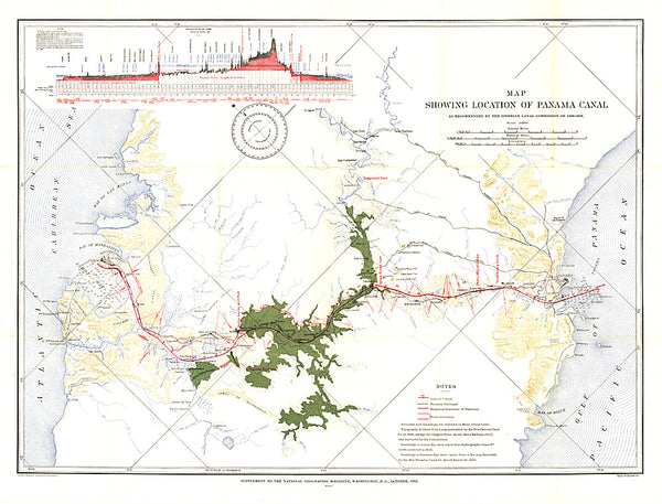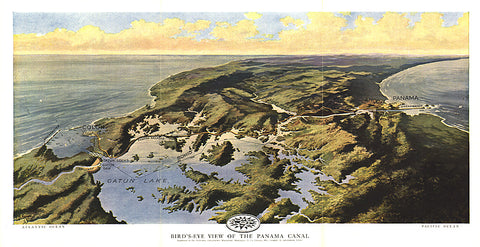
1912 Birds Eye View of the Panama Canal Map
Published in February 1912 two years before the Panama Canal opened, this stunning relief map-painting illustrates the Panama railroad, locks, breakwater, and other details of the region. One of the largest engineering projects ever undertaken, the canal had an enormous impact on shipping, creating a passage between the Pacific and Atlantic Oceans. Prior to the canals opening, ships had to travel the long and treacherous route around the tip of South America.
- Product Number: PODHNG_PAN_12
- Reference Product Number: 2321534M
- ISBN: - None -
- Date of Publication: 6/1/1912
- Unfolded (flat) Size: 9.5 inches high by 18.75 inches wide
- Map format: Wall
- Map type: Trade Maps - Wall Art
- Geographical region: Panama