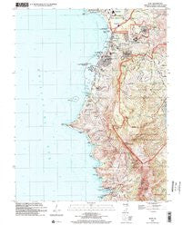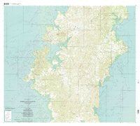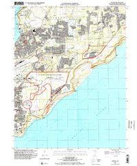
~ Dededo GU topo map, 1:24000 scale, 7.5 X 7.5 Minute, Historical, 2000, updated 2002
Dededo, Guam, USGS topographic map dated 2000.
Includes geographic coordinates (latitude and longitude). This topographic map is suitable for hiking, camping, and exploring, or framing it as a wall map.
Printed on-demand using high resolution imagery, on heavy weight and acid free paper, or alternatively on a variety of synthetic materials.
Topos available on paper, Waterproof, Poly, or Tyvek. Usually shipping rolled, unless combined with other folded maps in one order.
- Product Number: USGS-5930091
- Free digital map download (high-resolution, GeoPDF): Dededo, Guam (file size: 9 MB)
- Map Size: please refer to the dimensions of the GeoPDF map above
- Weight (paper map): ca. 55 grams
- Map Type: POD USGS Topographic Map
- Map Series: HTMC
- Map Verison: Historical
- Cell ID: 11672
- Scan ID: 462382
- Imprint Year: 2002
- Woodland Tint: Yes
- Aerial Photo Year: 2000
- Datum: NAD83
- Map Projection: Universal Transverse Mercator
- Map published by United States Geological Survey
- Map Language: English
- Scanner Resolution: 600 dpi
- Map Cell Name: Dededo
- Grid size: 7.5 X 7.5 Minute
- Date on map: 2000
- Map Scale: 1:24000
- Geographical region: Guam, United States
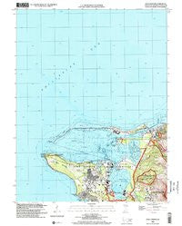
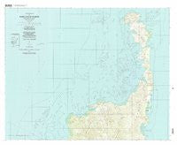
Neighboring Maps:
All neighboring USGS topo maps are available for sale online at a variety of scales.
Spatial coverage:
Topo map Dededo, Guam, covers the geographical area associated the following places:
- South Acres - Mangilao - Summer Place Subdivision - Tumhun (historical) - Ypaopao Estates - Marianas Terrace - Ponderosa Gardens - Wettengel Junction - Asatdas - Latte Plantation - Harmon Garden - Bordallo Subdivision - Barrigada Heights - Harmon Park Subdivision - Spring Hill Subdivision - Hafa Adai Village Subdivision - Ipapao - Yigo - Asbeco - Corten Torres - Carlos Heights - Nisshio Subdivision - Latte Heights Estates - Adacao - Ungaguan - Upper Kaiser - Pagat - Las Palmas Subdivision - Takano Subdivision - Perez Acres - Salas Subdivision - San Antonio - Tumon - Macheche Village Subdivision - Lalo - Manaca - Leyan - Dededo - Harmon Village
- Map Area ID: AREA13.541666713.4166667144.8144.9
- Northwest corner Lat/Long code: USGSNW13.5416667144.8
- Northeast corner Lat/Long code: USGSNE13.5416667144.9
- Southwest corner Lat/Long code: USGSSW13.4166667144.8
- Southeast corner Lat/Long code: USGSSE13.4166667144.9
- Northern map edge Latitude: 13.5416667
- Southern map edge Latitude: 13.4166667
- Western map edge Longitude: 144.8
- Eastern map edge Longitude: 144.9