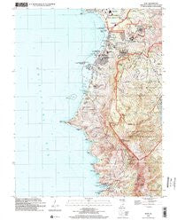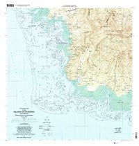
~ Island Of Pohnpei Southwest FM topo map, 1:25000 scale, 7.5 X 7.5 Minute, Historical, 2001, updated 2002
Island Of Pohnpei Southwest , Federated States of Micronesia, USGS topographic map dated 2001.
Includes geographic coordinates (latitude and longitude). This topographic map is suitable for hiking, camping, and exploring, or framing it as a wall map.
Printed on-demand using high resolution imagery, on heavy weight and acid free paper, or alternatively on a variety of synthetic materials.
Topos available on paper, Waterproof, Poly, or Tyvek. Usually shipping rolled, unless combined with other folded maps in one order.
- Product Number: USGS-5930057
- Free digital map download (high-resolution, GeoPDF): Island Of Pohnpei Southwest , Federated States of Micronesia (file size: 14 MB)
- Map Size: please refer to the dimensions of the GeoPDF map above
- Weight (paper map): ca. 55 grams
- Map Type: POD USGS Topographic Map
- Map Series: HTMC
- Map Verison: Historical
- Cell ID: 395615
- Scan ID: 462385
- Imprint Year: 2002
- Woodland Tint: Yes
- Aerial Photo Year: 2001
- Datum: NAD83
- Map Projection: Universal Transverse Mercator
- Map published by United States Geological Survey
- Map Language: English
- Scanner Resolution: 600 dpi
- Map Cell Name: Island of Pohnpei (Southwest)
- Grid size: 7.5 X 7.5 Minute
- Date on map: 2001
- Map Scale: 1:25000
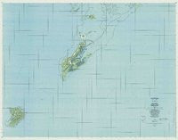
- Geographical region: Federated States of Micronesia, United States
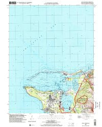
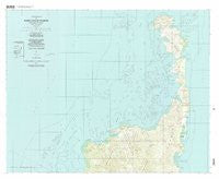
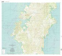
Neighboring Maps:
All neighboring USGS topo maps are available for sale online at a variety of scales.
Spatial coverage:
Topo map Island Of Pohnpei Southwest , Federated States of Micronesia, covers the geographical area associated the following places:
- Ninlong - Mwelin - Pohnseiuh - Adohro - Pohnallap - Nan Paremwed - Kepkep - Pohn Imwinsapw - Pohn Paip - Pahn Kipar - Nan Keptik - Pohnmall - Pein Semwei - Pohn Semwet - Pohn Sok - Noahle - Mwasangapw - Pohn Saleng - Pohn Kali - Pohn Dolekirou - Pwudoi - Lapwusi - Pahn Diadi - Ikeme - Pohn Keimw - Dienpo - Sekeren Kahle - Rekihpas - Pwel Weita - Reikapw - Pohn Uhs - Sekeren Iap - Nin Loang - Pohn Auwas - Sekeren Lapahu - Loangen Rehwei - Naniepw - Nin Loang - Paieke - Pohnered - Kepin Rohi - Sekeren Pei - Loangen Semwei - Kedira - Sakartik - Malewehlap - Pakara - Ni Aul - Arapwa - Nan Lukop - Nanwei
- Map Area ID: AREA6.90833336.75158.0833333158.2333333
- Northwest corner Lat/Long code: USGSNW6.9083333158.0833333
- Northeast corner Lat/Long code: USGSNE6.9083333158.2333333
- Southwest corner Lat/Long code: USGSSW6.75158.0833333
- Southeast corner Lat/Long code: USGSSE6.75158.2333333
- Northern map edge Latitude: 6.9083333
- Southern map edge Latitude: 6.75
- Western map edge Longitude: 158.0833333
- Eastern map edge Longitude: 158.2333333