
~ Yamhill River OR topo map, 1:100000 scale, 30 X 60 Minute, Historical, 1980, updated 1987
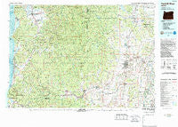
Yamhill River, Oregon, USGS topographic map dated 1980.
Includes geographic coordinates (latitude and longitude). This topographic map is suitable for hiking, camping, and exploring, or framing it as a wall map.
Printed on-demand using high resolution imagery, on heavy weight and acid free paper, or alternatively on a variety of synthetic materials.
Topos available on paper, Waterproof, Poly, or Tyvek. Usually shipping rolled, unless combined with other folded maps in one order.
- Product Number: USGS-5686435
- Free digital map download (high-resolution, GeoPDF): Yamhill River, Oregon (file size: 33 MB)
- Map Size: please refer to the dimensions of the GeoPDF map above
- Weight (paper map): ca. 55 grams
- Map Type: POD USGS Topographic Map
- Map Series: HTMC
- Map Verison: Historical
- Cell ID: 68621
- Scan ID: 283131
- Imprint Year: 1987
- Woodland Tint: Yes
- Visual Version Number: 2
- Aerial Photo Year: 1977
- Edit Year: 1980
- Datum: NAD27
- Map Projection: Universal Transverse Mercator
- Map published by United States Geological Survey
- Keywords: Overedge with No Adjacent Map
- Map Language: English
- Scanner Resolution: 600 dpi
- Map Cell Name: Yamhill River
- Grid size: 30 X 60 Minute
- Date on map: 1980
- Map Scale: 1:100000
- Geographical region: Oregon, United States
Neighboring Maps:
All neighboring USGS topo maps are available for sale online at a variety of scales.
Spatial coverage:
Topo map Yamhill River, Oregon, covers the geographical area associated the following places:
- Dewey (historical) - Eola Crest - Sheridan - Neotsu - Grand Ronde - Bellevue - Cherry Grove - Wheatland - Fairview - Amity - Oceanside - Boyer - Netarts - Dilley - Patton - Gaston - Eola Village - Cape Meares - Cove Orchard - Neskowin - Laurelwood - Bethel - Clear Lake - Ballston - Sandlake - Tierra Del Mar - Yamhill - Midway - Hebo - Oretown - Tillamook - Lakebrook - Dayton - Otis - Rose Lodge - Perrydale - Beaver - Three Rocks - Fort Hill Census Designated Place - Happy Hollow - Hemlock - Nenamusa (historical) - Saint Joseph - Bethel Heights - Unionvale - Meda - Woods - Blooming - Valley Junction - Buell - Zena - Lunnville - Pacific City - Hathaway Mead - Cloverdale - Carlton - Tucker (historical) - Fairfield - Whiteson - Lafayette - Fairdale (historical) - Willamina - Lincoln - McMinnville - McCoy - Hopewell - Dundee - Blaine - Pleasant Valley - Broadmead - Grand Ronde Agency - Sunnycrest
- Map Area ID: AREA45.545-124-123
- Northwest corner Lat/Long code: USGSNW45.5-124
- Northeast corner Lat/Long code: USGSNE45.5-123
- Southwest corner Lat/Long code: USGSSW45-124
- Southeast corner Lat/Long code: USGSSE45-123
- Northern map edge Latitude: 45.5
- Southern map edge Latitude: 45
- Western map edge Longitude: -124
- Eastern map edge Longitude: -123


