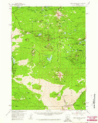
~ Three Fingered Jack OR topo map, 1:62500 scale, 15 X 15 Minute, Historical, 1959, updated 1961
Three Fingered Jack, Oregon, USGS topographic map dated 1959.
Includes geographic coordinates (latitude and longitude). This topographic map is suitable for hiking, camping, and exploring, or framing it as a wall map.
Printed on-demand using high resolution imagery, on heavy weight and acid free paper, or alternatively on a variety of synthetic materials.
Topos available on paper, Waterproof, Poly, or Tyvek. Usually shipping rolled, unless combined with other folded maps in one order.
- Product Number: USGS-5545482
- Free digital map download (high-resolution, GeoPDF): Three Fingered Jack, Oregon (file size: 8 MB)
- Map Size: please refer to the dimensions of the GeoPDF map above
- Weight (paper map): ca. 55 grams
- Map Type: POD USGS Topographic Map
- Map Series: HTMC
- Map Verison: Historical
- Cell ID: 63543
- Scan ID: 282949
- Imprint Year: 1961
- Woodland Tint: Yes
- Aerial Photo Year: 1957
- Field Check Year: 1959
- Datum: NAD27
- Map Projection: Polyconic
- Map published by United States Geological Survey
- Map Language: English
- Scanner Resolution: 600 dpi
- Map Cell Name: Three Fingered Jack
- Grid size: 15 X 15 Minute
- Date on map: 1959
- Map Scale: 1:62500
- Geographical region: Oregon, United States
Neighboring Maps:
All neighboring USGS topo maps are available for sale online at a variety of scales.
Spatial coverage:
Topo map Three Fingered Jack, Oregon, covers the geographical area associated the following places:
- Torso Lake - Hidden Valley - Bone Lake - Link Creek Campground Boat Ramp - Sand Camp Lake - Potato Hill - Suttle Lake Water Ski - Lava Camp Lake - Dollar Nine Lake - Nash Crater - South Loop Trail - Canyon Creek Meadows - Great Spring - Brandenburg Butte - Dark Lake - Round Lake Recreation Site - North Dixie Lake - Ralphs Lake - Round Lake - Hoodoo Butte - Clear Lake - Link Creek Recreation Site - Dugout Lake - Koosah Falls Recreation Site - Santiam Junction - Circle Lake - Little Duffy Lake - Coldwater Spring - Hortense Lake - Little Belknap - Duffy Lake Trail - Lava Trail - Clear Lake Resort - Swede Creek - Hoodoo Ski Bowl - Windy Point - Link Lake - Lost Lake Campground (historical) - Meadow Lake - Santiam Junction State Airport - First Creek Camp - Big Lake West Recreation Site - Presbyterian Organization Site - Long Lake - Big Lake Recreation Site - Toms Lake - Clear Lake Resort Boat Ramp - Ice Cap Creek Campground Unimproved Boat Launch - Round Lake Trail - Lower Berley Lake - Sahalie Falls Recreation Site - Little Cincha Lake - Santiam Pass - Twin Craters - Little Lake - Washington Ponds - Icecap Spring - Martin Lake - South Loop Cut Off - Ray Benson Sno-Park - Little Cache Mountain - Hayrick Butte - Patjens Lakes - Big Spring - Suttle Lake Waterski Area Boat Ramp - Porcupine Peak - Duffy Lake - Craig Lake - Seventh Day Adventist Organization Camp - Island Lake - Big Meadows Horse Camp - Cache Creek Toll Station - Lost Lake Creek - Anderson Ridge Trail - Three Fingered Jack - Black Crater - Mount Washington - Sahalie Falls - Upper Berley Lake - Maxwell Lake - Dugout Butte - George Lake - Ice Cap Creek - Elliot R Corbett II Memorial State Park - Kuitan Lake - Jack Lake Recreation Site - Clear Lake Recreation Site - Santiam Sno-Park - Robinson Lake - Cache Mountain - Latigo Lake - Camp Tamarack - Deer Butte Trail - Belknap Crater - Thirsty Camp Trail - Lava Camp Lake Recreation Site - Blue Lake Resort - Bunchgrass Ridge - Jack Lake - Booth Lake
- Map Area ID: AREA44.544.25-122-121.75
- Northwest corner Lat/Long code: USGSNW44.5-122
- Northeast corner Lat/Long code: USGSNE44.5-121.75
- Southwest corner Lat/Long code: USGSSW44.25-122
- Southeast corner Lat/Long code: USGSSE44.25-121.75
- Northern map edge Latitude: 44.5
- Southern map edge Latitude: 44.25
- Western map edge Longitude: -122
- Eastern map edge Longitude: -121.75

