
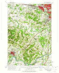
~ Beaverton OR topo map, 1:62500 scale, 15 X 15 Minute, Historical, 1961, updated 1963
Beaverton, Oregon, USGS topographic map dated 1961.
Includes geographic coordinates (latitude and longitude). This topographic map is suitable for hiking, camping, and exploring, or framing it as a wall map.
Printed on-demand using high resolution imagery, on heavy weight and acid free paper, or alternatively on a variety of synthetic materials.
Topos available on paper, Waterproof, Poly, or Tyvek. Usually shipping rolled, unless combined with other folded maps in one order.
- Product Number: USGS-5544246
- Free digital map download (high-resolution, GeoPDF): Beaverton, Oregon (file size: 11 MB)
- Map Size: please refer to the dimensions of the GeoPDF map above
- Weight (paper map): ca. 55 grams
- Map Type: POD USGS Topographic Map
- Map Series: HTMC
- Map Verison: Historical
- Cell ID: 51086
- Scan ID: 282248
- Imprint Year: 1963
- Woodland Tint: Yes
- Datum: NAD27
- Map Projection: Polyconic
- Map published by United States Geological Survey
- Map Language: English
- Scanner Resolution: 600 dpi
- Map Cell Name: Beaverton
- Grid size: 15 X 15 Minute
- Date on map: 1961
- Map Scale: 1:62500
- Geographical region: Oregon, United States
Neighboring Maps:
All neighboring USGS topo maps are available for sale online at a variety of scales.
Spatial coverage:
Topo map Beaverton, Oregon, covers the geographical area associated the following places:
- Buckheaven - Reedville - Butteville - Tobias - Raleigh Hills - Tigard - Springbrook - Tualatin - Charbonneau - Sherwood - Middleton - Six Corners - Norwood - Durham - Whitford - Rex - Garden Home - Chehalem - Huber - Scholls - Farmington - Metzger - Bradley Corner - Kinton - Aloha - Midway - West Slope - Laurel - Bonita - Beaverton - Ladd Hill - Hazeldale - Wilsonville - Mulloy - Hoodview - King City - Newberg - Progress
- Map Area ID: AREA45.545.25-123-122.75
- Northwest corner Lat/Long code: USGSNW45.5-123
- Northeast corner Lat/Long code: USGSNE45.5-122.75
- Southwest corner Lat/Long code: USGSSW45.25-123
- Southeast corner Lat/Long code: USGSSE45.25-122.75
- Northern map edge Latitude: 45.5
- Southern map edge Latitude: 45.25
- Western map edge Longitude: -123
- Eastern map edge Longitude: -122.75


