
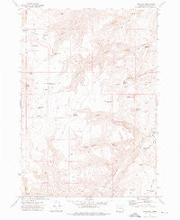
~ Tims Peak OR topo map, 1:24000 scale, 7.5 X 7.5 Minute, Historical, 1972, updated 1974
Tims Peak, Oregon, USGS topographic map dated 1972.
Includes geographic coordinates (latitude and longitude). This topographic map is suitable for hiking, camping, and exploring, or framing it as a wall map.
Printed on-demand using high resolution imagery, on heavy weight and acid free paper, or alternatively on a variety of synthetic materials.
Topos available on paper, Waterproof, Poly, or Tyvek. Usually shipping rolled, unless combined with other folded maps in one order.
- Product Number: USGS-5422314
- Free digital map download (high-resolution, GeoPDF): Tims Peak, Oregon (file size: 11 MB)
- Map Size: please refer to the dimensions of the GeoPDF map above
- Weight (paper map): ca. 55 grams
- Map Type: POD USGS Topographic Map
- Map Series: HTMC
- Map Verison: Historical
- Cell ID: 45174
- Scan ID: 281838
- Imprint Year: 1974
- Woodland Tint: Yes
- Aerial Photo Year: 1971
- Field Check Year: 1972
- Datum: NAD27
- Map Projection: Lambert Conformal Conic
- Map published by United States Geological Survey
- Map Language: English
- Scanner Resolution: 600 dpi
- Map Cell Name: Tims Peak
- Grid size: 7.5 X 7.5 Minute
- Date on map: 1972
- Map Scale: 1:24000
- Geographical region: Oregon, United States
Neighboring Maps:
All neighboring USGS topo maps are available for sale online at a variety of scales.
Spatial coverage:
Topo map Tims Peak, Oregon, covers the geographical area associated the following places:
- McCloud Spring - Tims Creek - T P Spring - Ha-ng isa Reservoir - Gacey Spring - Rufino Gulch - Gold Creek Reservoir Number Two - Wildcat Waterhole - Gold Creek Reservoir Number One - Roy Reservoir - West Fork Cottonwood Creek - Hanna Reservoir - Tims Peak - Kwii-na-a Spring - Tims Peak Spring - Wildcat Creek - Gold Spring - Green Gulch - Camp Creek - Antelope Swale Spring - Tims Peak Reservoir - McCloud-Field Reservoir - Stringer Shearing Plant - Sunnyslope Pit - Antelope Swale - Gage Reservoir - Short Creek - Little Cottonwood Creek - Shearing Plant Reservoir - Middle Rim Reservoir - Long Creek - Coleman Spring - Green Gulch Spring - Cow Camp Spring - Hat Top
- Map Area ID: AREA43.7543.625-117.875-117.75
- Northwest corner Lat/Long code: USGSNW43.75-117.875
- Northeast corner Lat/Long code: USGSNE43.75-117.75
- Southwest corner Lat/Long code: USGSSW43.625-117.875
- Southeast corner Lat/Long code: USGSSE43.625-117.75
- Northern map edge Latitude: 43.75
- Southern map edge Latitude: 43.625
- Western map edge Longitude: -117.875
- Eastern map edge Longitude: -117.75


