
~ Thimbleberry Mtn OR topo map, 1:24000 scale, 7.5 X 7.5 Minute, Historical, 1964, updated 1984
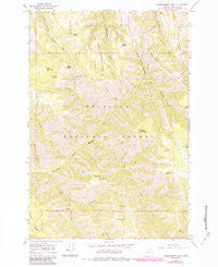
Thimbleberry Mtn, Oregon, USGS topographic map dated 1964.
Includes geographic coordinates (latitude and longitude). This topographic map is suitable for hiking, camping, and exploring, or framing it as a wall map.
Printed on-demand using high resolution imagery, on heavy weight and acid free paper, or alternatively on a variety of synthetic materials.
Topos available on paper, Waterproof, Poly, or Tyvek. Usually shipping rolled, unless combined with other folded maps in one order.
- Product Number: USGS-5422238
- Free digital map download (high-resolution, GeoPDF): Thimbleberry Mtn, Oregon (file size: 16 MB)
- Map Size: please refer to the dimensions of the GeoPDF map above
- Weight (paper map): ca. 55 grams
- Map Type: POD USGS Topographic Map
- Map Series: HTMC
- Map Verison: Historical
- Cell ID: 44849
- Scan ID: 281798
- Imprint Year: 1984
- Woodland Tint: Yes
- Photo Revision Year: 1983
- Aerial Photo Year: 1981
- Edit Year: 1983
- Field Check Year: 1981
- Datum: NAD27
- Map Projection: Polyconic
- Map published by United States Geological Survey
- Map Language: English
- Scanner Resolution: 600 dpi
- Map Cell Name: Thimbleberry Mountain
- Grid size: 7.5 X 7.5 Minute
- Date on map: 1964
- Map Scale: 1:24000
- Geographical region: Oregon, United States
Neighboring Maps:
All neighboring USGS topo maps are available for sale online at a variety of scales.
Spatial coverage:
Topo map Thimbleberry Mtn, Oregon, covers the geographical area associated the following places:
- Thimbleberry Mountain - Bear Camp Spring - Goodman Lookout Tower - McDonald Ridge - Huckleberry Mountain - Huckleberry Spring - Farley Spring - Canyon Creek - Little Goodman Ridge - Banjo Spring - Pole Spring - North Side Spring - Trap Creek - Dusty Saddle - Slusher Creek - Jake Creek - Hellhole Creek - Dead Horse Spring - Bear Creek - Wilbur Mountain - Creek Spring - Goodman Ridge - Dusty Saddle Canyon - Pot Creek - The Knob - Black Mountain Spring - End Spring - Hoskins Creek - Pileup Saddle - Gray Rock - Black Mountain - Cold Spring - Rocky Bedground
- Map Area ID: AREA45.62545.5-118.25-118.125
- Northwest corner Lat/Long code: USGSNW45.625-118.25
- Northeast corner Lat/Long code: USGSNE45.625-118.125
- Southwest corner Lat/Long code: USGSSW45.5-118.25
- Southeast corner Lat/Long code: USGSSE45.5-118.125
- Northern map edge Latitude: 45.625
- Southern map edge Latitude: 45.5
- Western map edge Longitude: -118.25
- Eastern map edge Longitude: -118.125


