
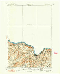
~ The Dalles OR topo map, 1:125000 scale, 30 X 30 Minute, Historical, 1934, updated 1950
The Dalles, Oregon, USGS topographic map dated 1934.
Includes geographic coordinates (latitude and longitude). This topographic map is suitable for hiking, camping, and exploring, or framing it as a wall map.
Printed on-demand using high resolution imagery, on heavy weight and acid free paper, or alternatively on a variety of synthetic materials.
Topos available on paper, Waterproof, Poly, or Tyvek. Usually shipping rolled, unless combined with other folded maps in one order.
- Product Number: USGS-5411454
- Free digital map download (high-resolution, GeoPDF): The Dalles, Oregon (file size: 7 MB)
- Map Size: please refer to the dimensions of the GeoPDF map above
- Weight (paper map): ca. 55 grams
- Map Type: POD USGS Topographic Map
- Map Series: HTMC
- Map Verison: Historical
- Cell ID: 66769
- Scan ID: 244252
- Imprint Year: 1950
- Survey Year: 1930
- Datum: Unstated
- Map Projection: Polyconic
- Map published by United States Geological Survey
- Map Language: English
- Scanner Resolution: 600 dpi
- Map Cell Name: The Dalles
- Grid size: 30 X 30 Minute
- Date on map: 1934
- Map Scale: 1:125000
- Geographical region: Oregon, United States
Neighboring Maps:
All neighboring USGS topo maps are available for sale online at a variety of scales.
Spatial coverage:
Topo map The Dalles, Oregon, covers the geographical area associated the following places:
- Lyle - English (historical) - Dallesport - Laws Corner - Mountain Brook - Petersburg - Wahkiacus - The Dalles - Fairbanks - Straight Point - Cherry Heights - Ortley - Appleton - Snowden - Woodruff Mill - Gilmer - Husum - Laurel - Klickitat Heights - Gooseneck - Pitt - Klickitat Springs - Chenoweth - Rowena - Bingen - White Salmon - Murdock - Klickitat - Smithville - Mosier - Swale
- Map Area ID: AREA4645.5-121.5-121
- Northwest corner Lat/Long code: USGSNW46-121.5
- Northeast corner Lat/Long code: USGSNE46-121
- Southwest corner Lat/Long code: USGSSW45.5-121.5
- Southeast corner Lat/Long code: USGSSE45.5-121
- Northern map edge Latitude: 46
- Southern map edge Latitude: 45.5
- Western map edge Longitude: -121.5
- Eastern map edge Longitude: -121


