
~ Wyandotte OK topo map, 1:125000 scale, 30 X 30 Minute, Historical, 1907, updated 1960
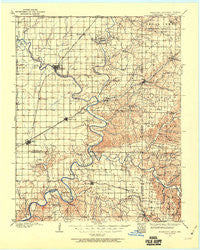
Wyandotte, Oklahoma, USGS topographic map dated 1907.
Includes geographic coordinates (latitude and longitude). This topographic map is suitable for hiking, camping, and exploring, or framing it as a wall map.
Printed on-demand using high resolution imagery, on heavy weight and acid free paper, or alternatively on a variety of synthetic materials.
Topos available on paper, Waterproof, Poly, or Tyvek. Usually shipping rolled, unless combined with other folded maps in one order.
- Product Number: USGS-5473127
- Free digital map download (high-resolution, GeoPDF): Wyandotte, Oklahoma (file size: 7 MB)
- Map Size: please refer to the dimensions of the GeoPDF map above
- Weight (paper map): ca. 55 grams
- Map Type: POD USGS Topographic Map
- Map Series: HTMC
- Map Verison: Historical
- Cell ID: 66978
- Scan ID: 802468
- Imprint Year: 1960
- Survey Year: 1907
- Datum: NAD27
- Map Projection: Polyconic
- Map published by United States Geological Survey
- Map Language: English
- Scanner Resolution: 508 dpi
- Map Cell Name: Wyandotte
- Grid size: 30 X 30 Minute
- Date on map: 1907
- Map Scale: 1:125000
- Geographical region: Oklahoma, United States
Neighboring Maps:
All neighboring USGS topo maps are available for sale online at a variety of scales.
Spatial coverage:
Topo map Wyandotte, Oklahoma, covers the geographical area associated the following places:
- Narcissa - May - Wyandotte - North Miami - Commerce - Hart - Dotyville - Dawes - Racine - Enterprise (historical) - Bernice - Coy - Turkey Ford - Ogeechee - Lincolnville - Hornet - Seneca - Oseuma - Kellyville - Dennis - Eastside - Picher (historical) - Westview - Cleora - Hockerville (historical) - Loma Linda - Dodge - Zincville (historical) - Copeland - Five Mile - Mills (historical) - Douthat (historical) - Cardin (historical) - Tiff City - Oak Grove - West Seneca - Moreville - Potter (historical) - Wela Park - Peoria - Spring City - Pack - Cayuga - Saratoga - Grove - Dessa - Fairland - Afton - Quapaw - Seneca Quapaw Agency (historical) - Miami - Ottawa - South West City
- Map Area ID: AREA3736.5-95-94.5
- Northwest corner Lat/Long code: USGSNW37-95
- Northeast corner Lat/Long code: USGSNE37-94.5
- Southwest corner Lat/Long code: USGSSW36.5-95
- Southeast corner Lat/Long code: USGSSE36.5-94.5
- Northern map edge Latitude: 37
- Southern map edge Latitude: 36.5
- Western map edge Longitude: -95
- Eastern map edge Longitude: -94.5


