
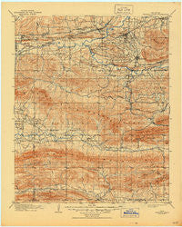
~ Winding Stair OK topo map, 1:125000 scale, 30 X 30 Minute, Historical, 1909, updated 1944
Winding Stair, Oklahoma, USGS topographic map dated 1909.
Includes geographic coordinates (latitude and longitude). This topographic map is suitable for hiking, camping, and exploring, or framing it as a wall map.
Printed on-demand using high resolution imagery, on heavy weight and acid free paper, or alternatively on a variety of synthetic materials.
Topos available on paper, Waterproof, Poly, or Tyvek. Usually shipping rolled, unless combined with other folded maps in one order.
- Product Number: USGS-5473121
- Free digital map download (high-resolution, GeoPDF): Winding Stair, Oklahoma (file size: 7 MB)
- Map Size: please refer to the dimensions of the GeoPDF map above
- Weight (paper map): ca. 55 grams
- Map Type: POD USGS Topographic Map
- Map Series: HTMC
- Map Verison: Historical
- Cell ID: 66959
- Scan ID: 802464
- Imprint Year: 1944
- Survey Year: 1898
- Datum: Unstated
- Map Projection: Polyconic
- Map published by United States Geological Survey
- Map Language: English
- Scanner Resolution: 508 dpi
- Map Cell Name: Winding Stair
- Grid size: 30 X 30 Minute
- Date on map: 1909
- Map Scale: 1:125000
- Geographical region: Oklahoma, United States
Neighboring Maps:
All neighboring USGS topo maps are available for sale online at a variety of scales.
Spatial coverage:
Topo map Winding Stair, Oklahoma, covers the geographical area associated the following places:
- Octavia - Wister - Summerfield - Ludlow - Big Cedar - Howe - Norris - Hodgens Station - Muse - Monroe - Cavanal - Stapp - Victor - Glendale - Hontubby - Hughes - Fanshawe - Forest Hill - Hodgen - Whitesboro - Forrester - Petros - Heavener - Haw Creek - Zoe - Lenox - Leflore - Honobia - Conser - Reichert - Independence - Braidwood - Caston - Page - Reichert
- Map Area ID: AREA3534.5-95-94.5
- Northwest corner Lat/Long code: USGSNW35-95
- Northeast corner Lat/Long code: USGSNE35-94.5
- Southwest corner Lat/Long code: USGSSW34.5-95
- Southeast corner Lat/Long code: USGSSE34.5-94.5
- Northern map edge Latitude: 35
- Southern map edge Latitude: 34.5
- Western map edge Longitude: -95
- Eastern map edge Longitude: -94.5


