
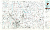
~ Youngstown OH topo map, 1:100000 scale, 30 X 60 Minute, Historical, 1986, updated 1988
Youngstown, Ohio, USGS topographic map dated 1986.
Includes geographic coordinates (latitude and longitude). This topographic map is suitable for hiking, camping, and exploring, or framing it as a wall map.
Printed on-demand using high resolution imagery, on heavy weight and acid free paper, or alternatively on a variety of synthetic materials.
Topos available on paper, Waterproof, Poly, or Tyvek. Usually shipping rolled, unless combined with other folded maps in one order.
- Product Number: USGS-5321548
- Free digital map download (high-resolution, GeoPDF): Youngstown, Ohio (file size: 18 MB)
- Map Size: please refer to the dimensions of the GeoPDF map above
- Weight (paper map): ca. 55 grams
- Map Type: POD USGS Topographic Map
- Map Series: HTMC
- Map Verison: Historical
- Cell ID: 68628
- Scan ID: 228342
- Imprint Year: 1988
- Aerial Photo Year: 1983
- Edit Year: 1986
- Datum: NAD27
- Map Projection: Universal Transverse Mercator
- Planimetric: Yes
- Map published by United States Geological Survey
- Map Language: English
- Scanner Resolution: 600 dpi
- Map Cell Name: Youngstown
- Grid size: 30 X 60 Minute
- Date on map: 1986
- Map Scale: 1:100000
- Geographical region: Ohio, United States
Neighboring Maps:
All neighboring USGS topo maps are available for sale online at a variety of scales.
Spatial coverage:
Topo map Youngstown, Ohio, covers the geographical area associated the following places:
- Delaware Grove - Wheatland - Millburn - McKinley Heights - Buckeye Mobile Home Park - Antietam (historical) - Brockway (historical) - New Bedford - Maderite Heights - Braceville Ridge - Brier Hill - Amsterdam - McGuffey Heights - Indian Run - West Austintown - Summit - Frizzleburg - Carmona - Five Points - Doughertys Mills - Lake Latonka - Paul's Trailer Park - Lynns Corners - King's Mobile Home Park - Lockwood - Clover - New Lebanon - Corinth - Leesburg Station - Newton Heights - Somerset 45 Manor - Taylor Corners - Oak Hill Mobile Home Park - Lobaugh - McCoytown - Five Points - Campbell - Vernon - Big Bend - Hope Mills - Crolls Mills - Kremis - Jackson Center - West River Park - Minnis Corner - Cedar Corners - Bobbys Corners - Schofield Corners - Belmar Park - Harrisville - Currys Mills - Tiger - Hann Hill - Farmdale - Midway Mobile Home Park - Brookfield Acres - Germantown (historical) - Williamston - Bentley (historical) - Fourmile Run - Hubbard - Armstrong - Cornersburg - Keisters - Mercer - Fairview - Madden Corners - Robinson - Greenville - Kyles Corners - Clarks Mills - Stoneboro - Mecca - Wildare - Petersburg - Halls Corners - Bowie - Four Seasons Mobile Home Park - Slippery Rock - Niles - Doughton (historical) - Dlworth - Lake Milton - Leechs Corners - Wassie (historical) - Warren - Hillsville - New Virginia - Carbon - Phalanx - Parkstown - Dublin - New Castle - Broad Acres - Sunset Beach - Scienceville - Stroups - Newton Falls - West Side - Fayette
- Map Area ID: AREA41.541-81-80
- Northwest corner Lat/Long code: USGSNW41.5-81
- Northeast corner Lat/Long code: USGSNE41.5-80
- Southwest corner Lat/Long code: USGSSW41-81
- Southeast corner Lat/Long code: USGSSE41-80
- Northern map edge Latitude: 41.5
- Southern map edge Latitude: 41
- Western map edge Longitude: -81
- Eastern map edge Longitude: -80


