
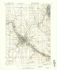
~ Youngstown OH topo map, 1:62500 scale, 15 X 15 Minute, Historical, 1906, updated 1958
Youngstown, Ohio, USGS topographic map dated 1906.
Includes geographic coordinates (latitude and longitude). This topographic map is suitable for hiking, camping, and exploring, or framing it as a wall map.
Printed on-demand using high resolution imagery, on heavy weight and acid free paper, or alternatively on a variety of synthetic materials.
Topos available on paper, Waterproof, Poly, or Tyvek. Usually shipping rolled, unless combined with other folded maps in one order.
- Product Number: USGS-5321442
- Free digital map download (high-resolution, GeoPDF): Youngstown, Ohio (file size: 6 MB)
- Map Size: please refer to the dimensions of the GeoPDF map above
- Weight (paper map): ca. 55 grams
- Map Type: POD USGS Topographic Map
- Map Series: HTMC
- Map Verison: Historical
- Cell ID: 64810
- Scan ID: 226459
- Imprint Year: 1958
- Survey Year: 1906
- Datum: NAD27
- Map Projection: Polyconic
- Map published by United States Geological Survey
- Map Language: English
- Scanner Resolution: 600 dpi
- Map Cell Name: Youngstown
- Grid size: 15 X 15 Minute
- Date on map: 1906
- Map Scale: 1:62500
- Geographical region: Ohio, United States
Neighboring Maps:
All neighboring USGS topo maps are available for sale online at a variety of scales.
Spatial coverage:
Topo map Youngstown, Ohio, covers the geographical area associated the following places:
- Sodom - Kyles Corners - Youngstown - Williamston - Coitsville Center - Haselton - Paul's Trailer Park - Boardman - East Side - Poland Center - Poland - Martin Mobile Home Park - King's Mobile Home Park - Midway Mobile Home Park - Bel Air Mobile Home Park - Cedar Park - West Hill - Fitch - Flint Hill - Howland Corners - Campbell - Brookfield Acres - Coalburg - Brookfield - Villa Maria - Brier Hill - Geography Hall - Starrs Corners - Masury - Petroleum - Hubbard - Bentley (historical) - Cornersburg - Hillcrest Trailer Court - Doughton (historical) - Klines Corner - Salow Corners - Churchill - Madden Corners - Fosterville - Newport (historical) - Cedar Corners - Girard - Summit - McDonald - Walnut Hill (historical) - McKinley Heights - Hells Corners - Perkins Corners - Paynes Corner - McGuffey Heights - Wickliffe - Loys Corners - Grimms Mobile Home Park - Hilltop - Thorn Hill - New Bedford - Suburban Mobile Home Park - Brookfield Center - Yankee Hills - Kansas Corners - Crab Creek Junction - Central Mobile Home Park - Maplewood Park - Tibbetts Corners - Lynns Corners - Howland Mobile Home Park - Stoneybrook Village Mobile Home Park - Fourmile Run - Scienceville - North Side - McKays Corners - Hakes Corners - West Side - South Side - Germantown (historical) - Halls Corners - Vienna - Lowellville - Struthers - Patagonia - Belmont Park - Ekerts Corners
- Map Area ID: AREA41.2541-80.75-80.5
- Northwest corner Lat/Long code: USGSNW41.25-80.75
- Northeast corner Lat/Long code: USGSNE41.25-80.5
- Southwest corner Lat/Long code: USGSSW41-80.75
- Southeast corner Lat/Long code: USGSSE41-80.5
- Northern map edge Latitude: 41.25
- Southern map edge Latitude: 41
- Western map edge Longitude: -80.75
- Eastern map edge Longitude: -80.5


