
~ Wooster OH topo map, 1:62500 scale, 15 X 15 Minute, Historical, 1901, updated 1961
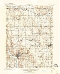
Wooster, Ohio, USGS topographic map dated 1901.
Includes geographic coordinates (latitude and longitude). This topographic map is suitable for hiking, camping, and exploring, or framing it as a wall map.
Printed on-demand using high resolution imagery, on heavy weight and acid free paper, or alternatively on a variety of synthetic materials.
Topos available on paper, Waterproof, Poly, or Tyvek. Usually shipping rolled, unless combined with other folded maps in one order.
- Product Number: USGS-5321432
- Free digital map download (high-resolution, GeoPDF): Wooster, Ohio (file size: 7 MB)
- Map Size: please refer to the dimensions of the GeoPDF map above
- Weight (paper map): ca. 55 grams
- Map Type: POD USGS Topographic Map
- Map Series: HTMC
- Map Verison: Historical
- Cell ID: 64722
- Scan ID: 226679
- Imprint Year: 1961
- Survey Year: 1901
- Datum: NAD27
- Map Projection: Polyconic
- Map published by United States Geological Survey
- Map Language: English
- Scanner Resolution: 600 dpi
- Map Cell Name: Wooster
- Grid size: 15 X 15 Minute
- Date on map: 1901
- Map Scale: 1:62500
- Geographical region: Ohio, United States
Neighboring Maps:
All neighboring USGS topo maps are available for sale online at a variety of scales.
Spatial coverage:
Topo map Wooster, Ohio, covers the geographical area associated the following places:
- Boys Village - Auburn Estates - Burnetts Corners - Miller Lakes - Forest Creek - Rittman - Indian Head Village - Sterling - Christmas Run - Mechanicsburg - Westwood - Burbank - Spruce Tree Village - Douglas (historical) - Guerne - Golden Corners - Forest View Mobile Home Park - Orrville Trailer Park - Art Smith Trailer Park - Devil Town - Meadow Brook - Glen Ridge Mobile Home Park - Five Points - Riceland - Deer Creek - Madisonburg - Whispering Pines Estates - Millbourne Mobile Manor - Little Chippewa Estates - Sunset Trailer Park - Orrville - Four T Mobile Home Park - Madison Hill - Wooster - Honeytown - Branstetter (historical) - Paradise (historical) - Smithville - Shel Mar Mobile Home Park - Creston - East Union - Hermanville - Ramblewood - Edinburgh - Weilersville - Highland Park - Hillcrest - West Canaan - The Meadows - Jackson - Melrose Village - Wooster Rolling Wheels - Wooster Trailer Park - Canaan - Linwood Heights - Parkview - Apple Creek - Johnsons Corners
- Map Area ID: AREA4140.75-82-81.75
- Northwest corner Lat/Long code: USGSNW41-82
- Northeast corner Lat/Long code: USGSNE41-81.75
- Southwest corner Lat/Long code: USGSSW40.75-82
- Southeast corner Lat/Long code: USGSSE40.75-81.75
- Northern map edge Latitude: 41
- Southern map edge Latitude: 40.75
- Western map edge Longitude: -82
- Eastern map edge Longitude: -81.75


