
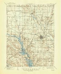
~ Ashland OH topo map, 1:62500 scale, 15 X 15 Minute, Historical, 1908, updated 1948
Ashland, Ohio, USGS topographic map dated 1908.
Includes geographic coordinates (latitude and longitude). This topographic map is suitable for hiking, camping, and exploring, or framing it as a wall map.
Printed on-demand using high resolution imagery, on heavy weight and acid free paper, or alternatively on a variety of synthetic materials.
Topos available on paper, Waterproof, Poly, or Tyvek. Usually shipping rolled, unless combined with other folded maps in one order.
- Product Number: USGS-5320636
- Free digital map download (high-resolution, GeoPDF): Ashland, Ohio (file size: 7 MB)
- Map Size: please refer to the dimensions of the GeoPDF map above
- Weight (paper map): ca. 55 grams
- Map Type: POD USGS Topographic Map
- Map Series: HTMC
- Map Verison: Historical
- Cell ID: 50724
- Scan ID: 224805
- Imprint Year: 1948
- Survey Year: 1906
- Datum: NAD
- Map Projection: Polyconic
- Map published by United States Geological Survey
- Map Language: English
- Scanner Resolution: 600 dpi
- Map Cell Name: Ashland
- Grid size: 15 X 15 Minute
- Date on map: 1908
- Map Scale: 1:62500
- Geographical region: Ohio, United States
Neighboring Maps:
All neighboring USGS topo maps are available for sale online at a variety of scales.
Spatial coverage:
Topo map Ashland, Ohio, covers the geographical area associated the following places:
- Carpenters Mobile Home Park - South Peninsula Cottage Area - Wooster Heights - Madison City Mobile Home Park - Epworth - Savannah - Nankin - Hidden Valley Mobile Home Park - Hillside Mobile Home Park - Westview Mobile Home Park - Mifflin - Sites Lake Cottage Area - Shady Lane Mobile Home Park - Trailerville Mobile Home Park - Forest Hills Mobile Park - Pavonia - Colonial Hills - Bailey Lake - Lincoln Heights - Fleming Falls - Five Points - Lake Silverstone Mobile Home Park - Olivesburg - Shenandoah - Twin Mobile Home Park - Pin Oak Mobile Home Park - Hopes Mobile Home Park - Ashland - Paradise Hill - Windsor - Ashfield Estates Mobile Home Park - Meadowbrook Mobile Home Park - East Mansfield - Mifflin Cottage Area - Hayesville - Fairview Mobile Home Park - Adario
- Map Area ID: AREA4140.75-82.5-82.25
- Northwest corner Lat/Long code: USGSNW41-82.5
- Northeast corner Lat/Long code: USGSNE41-82.25
- Southwest corner Lat/Long code: USGSSW40.75-82.5
- Southeast corner Lat/Long code: USGSSE40.75-82.25
- Northern map edge Latitude: 41
- Southern map edge Latitude: 40.75
- Western map edge Longitude: -82.5
- Eastern map edge Longitude: -82.25


