
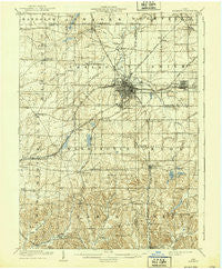
~ Alliance OH topo map, 1:62500 scale, 15 X 15 Minute, Historical, 1909, updated 1939
Alliance, Ohio, USGS topographic map dated 1909.
Includes geographic coordinates (latitude and longitude). This topographic map is suitable for hiking, camping, and exploring, or framing it as a wall map.
Printed on-demand using high resolution imagery, on heavy weight and acid free paper, or alternatively on a variety of synthetic materials.
Topos available on paper, Waterproof, Poly, or Tyvek. Usually shipping rolled, unless combined with other folded maps in one order.
- Product Number: USGS-5320608
- Free digital map download (high-resolution, GeoPDF): Alliance, Ohio (file size: 7 MB)
- Map Size: please refer to the dimensions of the GeoPDF map above
- Weight (paper map): ca. 55 grams
- Map Type: POD USGS Topographic Map
- Map Series: HTMC
- Map Verison: Historical
- Cell ID: 50443
- Scan ID: 224727
- Imprint Year: 1939
- Survey Year: 1907
- Datum: Unstated
- Map Projection: Polyconic
- Map published by United States Geological Survey
- Map Language: English
- Scanner Resolution: 600 dpi
- Map Cell Name: Alliance
- Grid size: 15 X 15 Minute
- Date on map: 1909
- Map Scale: 1:62500
- Geographical region: Ohio, United States
Neighboring Maps:
All neighboring USGS topo maps are available for sale online at a variety of scales.
Spatial coverage:
Topo map Alliance, Ohio, covers the geographical area associated the following places:
- Sebring - New Baltimore - New Franklin - Lexington - Alden Park - Myers - North Benton - Harrisburg - Alliance - McGarry (historical) - Paris - Limaville - Mount Union - Country Squire Mobile Home Park - Homeworth - Yeagleys Corners - Maximo - Reading - Marlboro - Chambersburg - East Alliance - Maple Ridge - New Guinea (historical) - Beechwood - Williamsport - Cutty Sunset Mobile Home Park - Alliance Junction - North Benton Station - Shaffers (historical) - Bayard - Pleasant Valley (historical) - Robertsville - Freeburg - Belfort - Bolton - Moultrie - Hillcrest - Maple Rest Mobile Court - Tecumseh Village Mobile Home Park
- Map Area ID: AREA4140.75-81.25-81
- Northwest corner Lat/Long code: USGSNW41-81.25
- Northeast corner Lat/Long code: USGSNE41-81
- Southwest corner Lat/Long code: USGSSW40.75-81.25
- Southeast corner Lat/Long code: USGSSE40.75-81
- Northern map edge Latitude: 41
- Southern map edge Latitude: 40.75
- Western map edge Longitude: -81.25
- Eastern map edge Longitude: -81


