
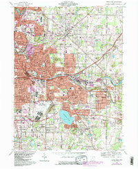
~ Akron East OH topo map, 1:24000 scale, 7.5 X 7.5 Minute, Historical, 1967, updated 1984
Akron East, Ohio, USGS topographic map dated 1967.
Includes geographic coordinates (latitude and longitude). This topographic map is suitable for hiking, camping, and exploring, or framing it as a wall map.
Printed on-demand using high resolution imagery, on heavy weight and acid free paper, or alternatively on a variety of synthetic materials.
Topos available on paper, Waterproof, Poly, or Tyvek. Usually shipping rolled, unless combined with other folded maps in one order.
- Product Number: USGS-5314780
- Free digital map download (high-resolution, GeoPDF): Akron East, Ohio (file size: 15 MB)
- Map Size: please refer to the dimensions of the GeoPDF map above
- Weight (paper map): ca. 55 grams
- Map Type: POD USGS Topographic Map
- Map Series: HTMC
- Map Verison: Historical
- Cell ID: 336
- Scan ID: 224704
- Imprint Year: 1984
- Woodland Tint: Yes
- Visual Version Number: 1
- Photo Revision Year: 1984
- Aerial Photo Year: 1982
- Edit Year: 1984
- Field Check Year: 1967
- Datum: NAD27
- Map Projection: Polyconic
- Map published by United States Geological Survey
- Map Language: English
- Scanner Resolution: 600 dpi
- Map Cell Name: Akron East
- Grid size: 7.5 X 7.5 Minute
- Date on map: 1967
- Map Scale: 1:24000
- Geographical region: Ohio, United States
Neighboring Maps:
All neighboring USGS topo maps are available for sale online at a variety of scales.
Spatial coverage:
Topo map Akron East, Ohio, covers the geographical area associated the following places:
- Mogadore - Six Corners - Pony - White House Park - The Willows - Trailer Village - Ellet - Sawyerwood - Thomastown - Lakemore - Boal's Trailer Park - Highland Mobile Home Park - Logtown - Bear's Mobile Home Park - Goodyear Heights - Ellet Heights Mobile Home Park - Krumroy - Coventry Estates - North Springfield - Bettes Corners - Gaslight Village Mobile Home Park - Frank's Mobile Home Park - Tallmadge - Plaza Trailer Court - East Akron - Brittain - Forest Hill - Derby Downs - Arlington
- Map Area ID: AREA41.12541-81.5-81.375
- Northwest corner Lat/Long code: USGSNW41.125-81.5
- Northeast corner Lat/Long code: USGSNE41.125-81.375
- Southwest corner Lat/Long code: USGSSW41-81.5
- Southeast corner Lat/Long code: USGSSE41-81.375
- Northern map edge Latitude: 41.125
- Southern map edge Latitude: 41
- Western map edge Longitude: -81.5
- Eastern map edge Longitude: -81.375


