
Ohio, Physical, laminated by Raven Press
Detailed physical wall map of Ohio State at a scale of 1:500,000. Laminated.
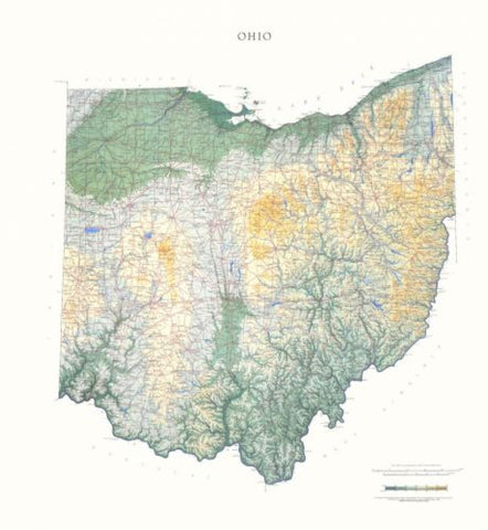
The cartography shows relief through a stunning, highly detailed shading, with different elevations varying in color, giving an almost 3-dimensional feel to the map. Peak heights are also clearly marked.
The map displays land only within the boundaries of the chosen states - there is no overlap with neighboring states. Principal physical features such as glaciers, mountain ranges, rivers and lakes are shown clearly. Human features, such as main towns, cities, roads and railways, are shown in a very fine, subtle and elegant cartographic style. State capitals are also clearly marked.
This map measures 107 x 97cm (42 x 38). The northern portion of Ohio shares 312 miles of shoreline with Lake Erie. The land then becomes part of the Till Plains, the beginning of the corn belt and one of the most fertile farming regions in the nation. The southern border is the historic Ohio River.
- Product Number: 2030691M
- Product Code: RP_OH_LA
- ISBN: 9780783425818
- Year of Publication: 1991
- Map type: Wall Map
- Geographical region: Ohio


