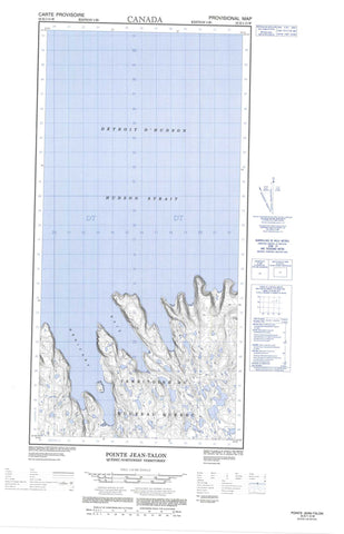
025E01W Pointe Jean Talon Canada topo map, 1:50,000 scale
025E01W Pointe Jean Talon NRCAN topographic map.
Includes UTM and GPS geographic coordinates (latitude and longitude). This 50k scale map is suitable for hiking, camping, and exploring, or you could frame it as a wall map.
Printed on-demand using high resolution, on heavy weight and acid free paper, or as an upgrade on a variety of synthetic materials.
Topos available on paper, Waterproof, Poly, or Tyvek. Usually shipping rolled, unless combined with other folded maps in one order.
- Halfsheet: This map was designed as a half sheet of NRCAN-025E01, and it is the Western half. Find the eastern half sheet here.
- Product Number: NRCAN-025E01W
- Parent Topo: TOPO-025E
- Map ID also known as: 025E01, 25E1, 25E01
- Unfolded Size: Approximately 26" high by 36" wide
- Weight (paper map): ca. 55 grams
- Map Type: POD NRCAN Topographic Map
- Map Scale: 1:50,000
- Geographical region: Nunavut, Canada
Neighboring Maps:
All neighboring Canadian topo maps are available for sale online at 1:50,000 scale.
Purchase the smaller scale map covering this area: Topo-025E
Spatial coverage:
Topo map sheet 025E01W Pointe Jean Talon covers the following places:
- Anse Iqiup Imanga - Anse Nuvuttuq - Baie Diana - Baie Héricart - Baie Héricart - Baie Tuvak - Diana Bay - Ekkik Cove - Tuvak Bay - Pointe Courcelles - Pointe d'Argenson - Pointe D'Argenson - Pointe d'Avaugour - Pointe D'Avaugour - Pointe de Mézy - Pointe De Mézy - Pointe Duchesnau - Pointe Fuvak - Pointe Hocquart - Pointe Jean-Talon - Pointe Strangulation - Pointe Tuvak - Tulugak Point - Détroit d'Hudson - Hudson Strait - Falaise Qutairquq - Diana Island - Ford Island - Imnak Island - Kingnektak Island - Smooth Island - Daryl Rock