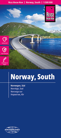
Norway, South Road Map
Southern Norway at 1:500,000 on a light, waterproof and tear-resistant, indexed road map, published by Reise Know-How as part of their highly acclaimed World Mapping Project. The map is double-sided to provide the best balance between a good scale and a convenient size sheet. Coverage extends north to Trondheim, with a small overlap between the sides.
Topography is shown by altitude colouring, with plenty of spot heights and names of mountain ranges, peaks, glaciers, fjords, etc. Road network includes small local roads and selected tracks, shows routes closed during winter, and gives driving distances on main routes. Railway lines and ferry connections are included and local airports are marked. The map also shows internal administrative boundaries and names of the provinces, as well as the boundaries of national parks. Symbols indicate various places of interest including campsites, tourist information, recreational areas, historical monuments, etc. Latitude and longitude li
- Product Number: RKH_NOR_S_23
- Reference Product Number: - None -
- ISBN: 9783831773527
- Date of Publication: 6/1/2023
- Folded Size: 10.24 inches high by 4.72 inches wide
- Unfolded (flat) Size: 39.76 inches high by 27.56 inches wide
- Map format: Folded
- Map type: Trade Maps - Road
- Geographical region: Norway