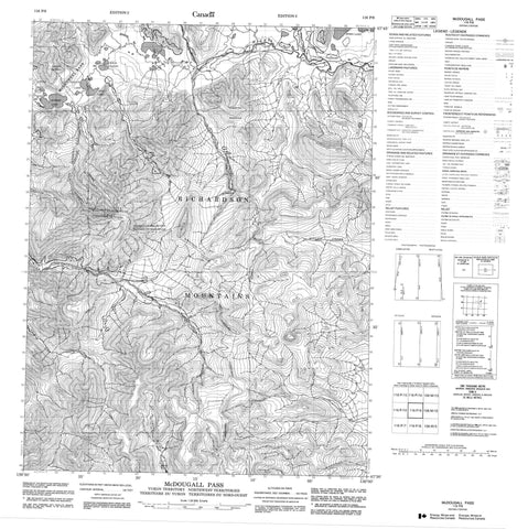
116P09 Mcdougall Pass Canada topo map, 1:50,000 scale
116P09 Mcdougall Pass NRCAN topographic map.
Includes UTM and GPS geographic coordinates (latitude and longitude). This 50k scale map is suitable for hiking, camping, and exploring, or you could frame it as a wall map.
Printed on-demand using high resolution, on heavy weight and acid free paper, or as an upgrade on a variety of synthetic materials.
Topos available on paper, Waterproof, Poly, or Tyvek. Usually shipping rolled, unless combined with other folded maps in one order.
- Product Number: NRCAN-116P09
- Parent Topo: TOPO-116P
- Map ID also known as: 116P09, 116P9
- Unfolded Size: Approximately 26" high by 36" wide
- Weight (paper map): ca. 55 grams
- Map Type: POD NRCAN Topographic Map
- Map Scale: 1:50,000
- Geographical region: Northwest Territories, Canada
Neighboring Maps:
All neighboring Canadian topo maps are available for sale online at 1:50,000 scale.
Purchase the smaller scale map covering this area: Topo-116P
Spatial coverage:
Topo map sheet 116P09 Mcdougall Pass covers the following places:
- Horn Lake - Long Lake - Ogilvie Lake - Summit Lake - Twin Lakes - Mount Russell - Richardson Mountains - Richardson Mountains - Symmetry Mountain - Fish Creek - Fish Creek - La Chute River - Little Bell River - Millen Creek - Rat River - Rat River - Scho Creek - Sheep Creek - Tundra Creek - Two Ocean Creek - Northwest Territories - Territoire du Yukon - Territoires du Nord-Ouest - Yukon Territory - McDougall Pass - McDougall Pass