
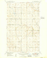
~ Burlington NE ND topo map, 1:24000 scale, 7.5 X 7.5 Minute, Historical, 1949
Burlington NE, North Dakota, USGS topographic map dated 1949.
Includes geographic coordinates (latitude and longitude). This topographic map is suitable for hiking, camping, and exploring, or framing it as a wall map.
Printed on-demand using high resolution imagery, on heavy weight and acid free paper, or alternatively on a variety of synthetic materials.
Topos available on paper, Waterproof, Poly, or Tyvek. Usually shipping rolled, unless combined with other folded maps in one order.
- Product Number: USGS-5474273
- Free digital map download (high-resolution, GeoPDF): Burlington NE, North Dakota (file size: 10 MB)
- Map Size: please refer to the dimensions of the GeoPDF map above
- Weight (paper map): ca. 55 grams
- Map Type: POD USGS Topographic Map
- Map Series: HTMC
- Map Verison: Historical
- Cell ID: 6278
- Scan ID: 283598
- Woodland Tint: Yes
- Aerial Photo Year: 1946
- Datum: NAD27
- Map Projection: Polyconic
- Map published by United States Geological Survey
- Map Language: English
- Scanner Resolution: 600 dpi
- Map Cell Name: Burlington NE
- Grid size: 7.5 X 7.5 Minute
- Date on map: 1949
- Map Scale: 1:24000
- Geographical region: North Dakota, United States
Neighboring Maps:
All neighboring USGS topo maps are available for sale online at a variety of scales.
Spatial coverage:
Topo map Burlington NE, North Dakota, covers the geographical area associated the following places:
- United States Air Force Regional Hospital - Copeland School Number 1 - Minot Air Force Base Census Designated Place - North Plains Elementary School - Montessori of Minot School - School Number 3 - Township of Tatman - Dakota Elementary School - Minot Air Force Base Fire Department - Department of Defense 5th Medical Group Ambulance Service - School Number 2 - School Number 3 - Rough Rider Golf Course - Minot Air Force Base - Minot Air Force Base - Memorial Middle School - School Number 4 - Minot Air Force Base Library - Lynch Church
- Map Area ID: AREA48.548.375-101.375-101.25
- Northwest corner Lat/Long code: USGSNW48.5-101.375
- Northeast corner Lat/Long code: USGSNE48.5-101.25
- Southwest corner Lat/Long code: USGSSW48.375-101.375
- Southeast corner Lat/Long code: USGSSE48.375-101.25
- Northern map edge Latitude: 48.5
- Southern map edge Latitude: 48.375
- Western map edge Longitude: -101.375
- Eastern map edge Longitude: -101.25


