
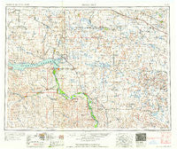
~ McClusky ND topo map, 1:250000 scale, 1 X 2 Degree, Historical, 1958, updated 1958
McClusky, North Dakota, USGS topographic map dated 1958.
Includes geographic coordinates (latitude and longitude). This topographic map is suitable for hiking, camping, and exploring, or framing it as a wall map.
Printed on-demand using high resolution imagery, on heavy weight and acid free paper, or alternatively on a variety of synthetic materials.
Topos available on paper, Waterproof, Poly, or Tyvek. Usually shipping rolled, unless combined with other folded maps in one order.
- Product Number: USGS-5473775
- Free digital map download (high-resolution, GeoPDF): McClusky, North Dakota (file size: 18 MB)
- Map Size: please refer to the dimensions of the GeoPDF map above
- Weight (paper map): ca. 55 grams
- Map Type: POD USGS Topographic Map
- Map Series: HTMC
- Map Verison: Historical
- Cell ID: 68900
- Scan ID: 285530
- Imprint Year: 1958
- Woodland Tint: Yes
- Aerial Photo Year: 1953
- Field Check Year: 1954
- Datum: Unstated
- Map Projection: Transverse Mercator
- Map published by United States Geological Survey
- Map published by United States Army Corps of Engineers
- Map published by United States Army
- Map Language: English
- Scanner Resolution: 600 dpi
- Map Cell Name: McClusky
- Grid size: 1 X 2 Degree
- Date on map: 1958
- Map Scale: 1:250000
- Geographical region: North Dakota, United States
Neighboring Maps:
All neighboring USGS topo maps are available for sale online at a variety of scales.
Spatial coverage:
Topo map McClusky, North Dakota, covers the geographical area associated the following places:
- Martin - Funston - Goodrich - Coleharbor - Butte - Wabek - Max - Arena - Beulah - Garrison - Prairie Junction - Washburn - Emmet - White Shield - Lincoln Valley - Knife River Village (historical) - Price - Stanton - Clifton - Turtle Lake - Baldwin - Still - Hensler - Underwood - Truax - Pick City - Regan - Hannover - Denhoff - Benedict - Wilton - Kief - Fort Clark - Wing - Falkirk - Otter Creek - Zap - McClusky - Ruso - Sanger - Ryder - Drake - Merida - Kongsberg - Hazen - Center - Roseglen - Mercer - Riverdale - Douglas - Balfour - Wogansport - Anamoose - Aylmer - Makoti - Pickardville - Riverdale Junction
- Map Area ID: AREA4847-102-100
- Northwest corner Lat/Long code: USGSNW48-102
- Northeast corner Lat/Long code: USGSNE48-100
- Southwest corner Lat/Long code: USGSSW47-102
- Southeast corner Lat/Long code: USGSSE47-100
- Northern map edge Latitude: 48
- Southern map edge Latitude: 47
- Western map edge Longitude: -102
- Eastern map edge Longitude: -100


