
~ Fargo ND topo map, 1:250000 scale, 1 X 2 Degree, Historical, 1956, updated 1956
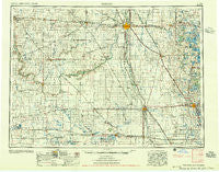
Fargo, North Dakota, USGS topographic map dated 1956.
Includes geographic coordinates (latitude and longitude). This topographic map is suitable for hiking, camping, and exploring, or framing it as a wall map.
Printed on-demand using high resolution imagery, on heavy weight and acid free paper, or alternatively on a variety of synthetic materials.
Topos available on paper, Waterproof, Poly, or Tyvek. Usually shipping rolled, unless combined with other folded maps in one order.
- Product Number: USGS-5473749
- Free digital map download (high-resolution, GeoPDF): Fargo, North Dakota (file size: 17 MB)
- Map Size: please refer to the dimensions of the GeoPDF map above
- Weight (paper map): ca. 55 grams
- Map Type: POD USGS Topographic Map
- Map Series: HTMC
- Map Verison: Historical
- Cell ID: 68776
- Scan ID: 285517
- Imprint Year: 1956
- Woodland Tint: Yes
- Aerial Photo Year: 1952
- Field Check Year: 1953
- Datum: Unstated
- Map Projection: Transverse Mercator
- Map published by United States Army Corps of Engineers
- Map published by United States Army
- Map Language: English
- Scanner Resolution: 600 dpi
- Map Cell Name: Fargo
- Grid size: 1 X 2 Degree
- Date on map: 1956
- Map Scale: 1:250000
- Geographical region: North Dakota, United States
Neighboring Maps:
All neighboring USGS topo maps are available for sale online at a variety of scales.
Spatial coverage:
Topo map Fargo, North Dakota, covers the geographical area associated the following places:
- Brockway (historical) - Brushvale - Wahpeton - Forman - Great Bend - Hample - Pinkham - Mapleton - Lake Park Trailer Court - Saint Benedict - Pelican Rapids Mobile Home Park - Comstock - Dunvilla - Rollag - South West Fargo - Squier - Sabin - Fairmount - Enderlin - Casselton - Barney - West Fargo - Dwight - Norwegian Grove - Oswald - Durbin - Barnesville - Newman - Averill - Lidgerwood - McLeod - Wild Rice - Wolverton - Dale - Horace - Greenwood Communities - Kent - Davenport - Elliott - Ransom City (historical) - Dilworth - Rutland - Koldok - Fergus Falls - Bayne - Walcott - Tower City - Campbell - Barrie - Rothsay Mobile Home Park - Crete - Elmore - Christine - Moorhead - Eastedge - Kragnes - Abercrombie - Glyndon - Kathryn - Wisner (historical) - Nicholson - Nashua - Oxbow - Baker - Oriska - North Valley City - Magnolia - Colfax - Fargo - Everdell - Cayuga - Stirum - Englevale - Fingal - Moselle - Boise De Sioux Mobile Estates - Anselm - Mantador - Everest - Galchutt - Enloe - Milnor - Myra - Prairie Rose - Chaffee - Geneseo - Lithia - Hawley - Western - Lucca - Cormorant - Buffalo - Parkdale - Doran - De Lamere - Fairview Junction - Harwood - Hitterdal - Dilworth Trailer Park - Hamlin
- Map Area ID: AREA4746-98-96
- Northwest corner Lat/Long code: USGSNW47-98
- Northeast corner Lat/Long code: USGSNE47-96
- Southwest corner Lat/Long code: USGSSW46-98
- Southeast corner Lat/Long code: USGSSE46-96
- Northern map edge Latitude: 47
- Southern map edge Latitude: 46
- Western map edge Longitude: -98
- Eastern map edge Longitude: -96


