
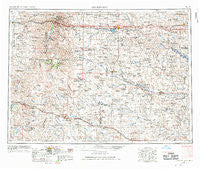
~ Dickinson ND topo map, 1:250000 scale, 1 X 2 Degree, Historical, 1953, updated 1968
Dickinson, North Dakota, USGS topographic map dated 1953.
Includes geographic coordinates (latitude and longitude). This topographic map is suitable for hiking, camping, and exploring, or framing it as a wall map.
Printed on-demand using high resolution imagery, on heavy weight and acid free paper, or alternatively on a variety of synthetic materials.
Topos available on paper, Waterproof, Poly, or Tyvek. Usually shipping rolled, unless combined with other folded maps in one order.
- Product Number: USGS-5473745
- Free digital map download (high-resolution, GeoPDF): Dickinson, North Dakota (file size: 19 MB)
- Map Size: please refer to the dimensions of the GeoPDF map above
- Weight (paper map): ca. 55 grams
- Map Type: POD USGS Topographic Map
- Map Series: HTMC
- Map Verison: Historical
- Cell ID: 68749
- Scan ID: 285515
- Imprint Year: 1968
- Woodland Tint: Yes
- Aerial Photo Year: 1952
- Edit Year: 1967
- Field Check Year: 1953
- Datum: Unstated
- Map Projection: Transverse Mercator
- Map published by United States Geological Survey
- Map published by United States Army Corps of Engineers
- Map published by United States Army
- Map Language: English
- Scanner Resolution: 600 dpi
- Map Cell Name: Dickinson
- Grid size: 1 X 2 Degree
- Date on map: 1953
- Map Scale: 1:250000
- Geographical region: North Dakota, United States
Neighboring Maps:
All neighboring USGS topo maps are available for sale online at a variety of scales.
Spatial coverage:
Topo map Dickinson, North Dakota, covers the geographical area associated the following places:
- Lehigh - Mound - Three V Crossing - Walser Crossing - Alpha - Scranton - Griffin - Fryburg - Bowman - Havelock - Chama - Dickinson - Regent - Lefor - Pierce - Gaylord - Richardton - Scoria Point - Mott - Marmarth - Daglum - Amidon - Rider - Zenith - Six Mile Corner - Eland - Hettinger - Gascoyne - Bentley - Taylor - Gladstone - Bucyrus - Buffalo Springs - New England - Ives - Schefield - Rhame - Hebron - Sully Springs - De Mores - Antelope - Ekre - Belfield - New Hradec - De Sart - Golva - South Heart - Sentinel Butte - Watrous - Medora - Reeder - Burt - Thelan - Mazda
- Map Area ID: AREA4746-104-102
- Northwest corner Lat/Long code: USGSNW47-104
- Northeast corner Lat/Long code: USGSNE47-102
- Southwest corner Lat/Long code: USGSSW46-104
- Southeast corner Lat/Long code: USGSSE46-102
- Northern map edge Latitude: 47
- Southern map edge Latitude: 46
- Western map edge Longitude: -104
- Eastern map edge Longitude: -102


