
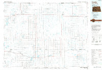
~ Crosby ND topo map, 1:100000 scale, 30 X 60 Minute, Historical, 1984, updated 1988
Crosby, North Dakota, USGS topographic map dated 1984.
Includes geographic coordinates (latitude and longitude). This topographic map is suitable for hiking, camping, and exploring, or framing it as a wall map.
Printed on-demand using high resolution imagery, on heavy weight and acid free paper, or alternatively on a variety of synthetic materials.
Topos available on paper, Waterproof, Poly, or Tyvek. Usually shipping rolled, unless combined with other folded maps in one order.
- Product Number: USGS-5473549
- Free digital map download (high-resolution, GeoPDF): Crosby, North Dakota (file size: 16 MB)
- Map Size: please refer to the dimensions of the GeoPDF map above
- Weight (paper map): ca. 55 grams
- Map Type: POD USGS Topographic Map
- Map Series: HTMC
- Map Verison: Historical
- Cell ID: 67362
- Scan ID: 285416
- Imprint Year: 1988
- Aerial Photo Year: 1982
- Edit Year: 1984
- Datum: NAD27
- Map Projection: Universal Transverse Mercator
- Planimetric: Yes
- Map published by United States Geological Survey
- Map Language: English
- Scanner Resolution: 600 dpi
- Map Cell Name: Crosby
- Grid size: 30 X 60 Minute
- Date on map: 1984
- Map Scale: 1:100000
- Geographical region: North Dakota, United States
Neighboring Maps:
All neighboring USGS topo maps are available for sale online at a variety of scales.
Spatial coverage:
Topo map Crosby, North Dakota, covers the geographical area associated the following places:
- Zahl - Wildrose - Alkabo - Grenora - Hanks - Ambrose - Paulson - Appam - Alamo - Fortuna - Corinth - Stady - Hamlet - Crosby - Juno - Noonan - Colgan - Kermit - Bounty
- Map Area ID: AREA4948.5-104-103
- Northwest corner Lat/Long code: USGSNW49-104
- Northeast corner Lat/Long code: USGSNE49-103
- Southwest corner Lat/Long code: USGSSW48.5-104
- Southeast corner Lat/Long code: USGSSE48.5-103
- Northern map edge Latitude: 49
- Southern map edge Latitude: 48.5
- Western map edge Longitude: -104
- Eastern map edge Longitude: -103


