
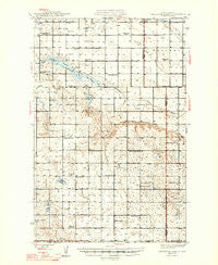
~ Sheyenne Lake ND topo map, 1:62500 scale, 15 X 15 Minute, Historical, 1947
Sheyenne Lake, North Dakota, USGS topographic map dated 1947.
Includes geographic coordinates (latitude and longitude). This topographic map is suitable for hiking, camping, and exploring, or framing it as a wall map.
Printed on-demand using high resolution imagery, on heavy weight and acid free paper, or alternatively on a variety of synthetic materials.
Topos available on paper, Waterproof, Poly, or Tyvek. Usually shipping rolled, unless combined with other folded maps in one order.
- Product Number: USGS-5473491
- Free digital map download (high-resolution, GeoPDF): Sheyenne Lake, North Dakota (file size: 8 MB)
- Map Size: please refer to the dimensions of the GeoPDF map above
- Weight (paper map): ca. 55 grams
- Map Type: POD USGS Topographic Map
- Map Series: HTMC
- Map Verison: Historical
- Cell ID: 62451
- Scan ID: 285385
- Datum: NAD27
- Map Projection: Polyconic
- Map published by United States Geological Survey
- Map Language: English
- Scanner Resolution: 600 dpi
- Map Cell Name: Sheyenne Lake
- Grid size: 15 X 15 Minute
- Date on map: 1947
- Map Scale: 1:62500
- Geographical region: North Dakota, United States
Neighboring Maps:
All neighboring USGS topo maps are available for sale online at a variety of scales.
Spatial coverage:
Topo map Sheyenne Lake, North Dakota, covers the geographical area associated the following places:
- Zion Cemetery - Berlin School Number 1 - Jones Lake - Schiller School Number 1 - Fairview School Number 3 - Fairview School Number 1 - Berlin School Number 2 - Fairview Cemetery - New Germantown School Number 1 - Berlin School Number 4 - New Germantown School Number 3 - Saint James Cemetery - Pioneer School Number 4 - Township of Berlin - Zion Church - Mennonite Church - Sorenson Lake - Township of Fairview - Boone Townhall - Pioneer School Number 1 - Frueh Private Field (historical) - Berlin School Number 3 - Lonetree Airstrip - Pony Gulch - Saint Johns Church - Wells County Waterfowl Production Area - Township of Boone - Saint Emanuel Cemetery - Lone Tree Lake - Sheyenne Lake - Township of Western - Mertz Slough - Coal Mine Lake
- Map Area ID: AREA47.7547.5-100.25-100
- Northwest corner Lat/Long code: USGSNW47.75-100.25
- Northeast corner Lat/Long code: USGSNE47.75-100
- Southwest corner Lat/Long code: USGSSW47.5-100.25
- Southeast corner Lat/Long code: USGSSE47.5-100
- Northern map edge Latitude: 47.75
- Southern map edge Latitude: 47.5
- Western map edge Longitude: -100.25
- Eastern map edge Longitude: -100


