
~ Yadkinville NC topo map, 1:125000 scale, 30 X 30 Minute, Historical, 1891, updated 1964
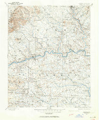
Yadkinville, North Carolina, USGS topographic map dated 1891.
Includes geographic coordinates (latitude and longitude). This topographic map is suitable for hiking, camping, and exploring, or framing it as a wall map.
Printed on-demand using high resolution imagery, on heavy weight and acid free paper, or alternatively on a variety of synthetic materials.
Topos available on paper, Waterproof, Poly, or Tyvek. Usually shipping rolled, unless combined with other folded maps in one order.
- Product Number: USGS-5374990
- Free digital map download (high-resolution, GeoPDF): Yadkinville, North Carolina (file size: 8 MB)
- Map Size: please refer to the dimensions of the GeoPDF map above
- Weight (paper map): ca. 55 grams
- Map Type: POD USGS Topographic Map
- Map Series: HTMC
- Map Verison: Historical
- Cell ID: 64853
- Scan ID: 164082
- Imprint Year: 1964
- Survey Year: 1891
- Datum: NAD27
- Map Projection: Polyconic
- Map published by United States Geological Survey
- Map Language: English
- Scanner Resolution: 600 dpi
- Map Cell Name: Adinville
- Grid size: 30 X 30 Minute
- Date on map: 1891
- Map Scale: 1:125000
- Geographical region: North Carolina, United States
Neighboring Maps:
All neighboring USGS topo maps are available for sale online at a variety of scales.
Spatial coverage:
Topo map Yadkinville, North Carolina, covers the geographical area associated the following places:
- Pine Ridge - Hamptonville - Friendship - Ronda - Indian Grove - Poindexter - High Meadows Estates - Devotion - Lone Hickory - Boonville - Shacktown - Pino - Beulah - Houstonville - Jonesville - Shady Grove - Sheltontown - New Castle (historical) - Lime Rock (historical) - Pleasant Hill - Marler - Crutchfield - Rich Hill - Rockford - Turkey Ford - Hare - State Road - Flat Shoals (historical) - Burch - Black Water - Zimmerman (historical) - Swan Creek - Cedar Hill - Courtney - Pleasant Ridge - Pea Ridge - Rena - White Plains - Elkin Valley - Dobson - Union Grove - Franklin - Farmington - Five Forks - Boones Hill - Union Grove - Oak Grove - Richmond Hill - Sugartown - Red Brush - Union Cross - Salemfork - Allin (historical) - Wyo - Roaring Gap - Mount Airy - Holly View Forest-Highland Park - Brooks Crossroads - Yadkinville - Zephyr - Mulberry - North Elkin - Ash Hill - Bannertown - Weatherspon (historical) - Holly Spring - Doughton - Osbornville - Pine Hill - Oak Grove - Windsors Crossroads - Long Hill - East Bend - Baltimore - Shoals - Mount Pleasant - Level Cross - Huntsville - Nebo - Ladonia - Brier Creek (historical) - Stony Knoll - Center - Ararat - Somers Crossroads - Martin (historical) - Cedar Forest Estates - Poplar Springs - Branon - Union Cross - Dimmette (historical) - Little Richmond - New Home (historical) - Arlington - Smithtown - Elkin - Eagle Mills - New Hope - Clingman - Lovelace (historical)
- Map Area ID: AREA36.536-81-80.5
- Northwest corner Lat/Long code: USGSNW36.5-81
- Northeast corner Lat/Long code: USGSNE36.5-80.5
- Southwest corner Lat/Long code: USGSSW36-81
- Southeast corner Lat/Long code: USGSSE36-80.5
- Northern map edge Latitude: 36.5
- Southern map edge Latitude: 36
- Western map edge Longitude: -81
- Eastern map edge Longitude: -80.5


